Now writing this on Monday so a compilation of activities and information from the weekend.
The Midnight Sun excursion I’d signed up for was a 4-hour van/bus trip. But I was the only passenger so I sat up front in the van and chatted with Eric: a Dutch journalist who migrated here with his wife 11 years ago.
They didn’t have enough Norwegian language to work in their usual professions here so took long and lucrative shifts in the local herring factory (3-4 month winter season). He continued to write occasional articles for the Dutch press and they bought a house (and then another) nearby as holiday rentals. The herring factory closed 3 years ago ( herring moving further offshore, operations moved to Denmark) and now he supplements the income with guiding.
He was initially confused what we would do without the sun to focus on but we made it up as we went along. We visited the next two islands further south (Gimsøy and Vestrågøy). Detoured through his ‘village’ – a straggly line of houses along the east coast road. Eleven permanent residents. The goat farmer has retired (40 goats), and the dairy farmer down the road (15 cows) is about to retire. Apparently this level of activity was sufficient to sustain them. And of course the animals have to be housed indoors in winter, though the snow out here on the islands with climate modified by the Gulf Stream doesn’t get as deep as on the mainland. Maybe only a metre or so. (The old folk tell of regular 2+m deep in years gone by.)
Back in 2004-6, all the small communities along this road banded together to bring family migrants from the Netherlands. (Eric wasn’t part of that scheme but had heard of it.) That sustained the school and shop for a few more years but most of those migrants have now gone home and school and shop recently closed. the long dark months and then long days take their toll.
Cod fishing remains the mainstay of the economy with the fishing season January-April. The cod are beheaded and gutted and hung to dry on large wooden racks for a couple of months.
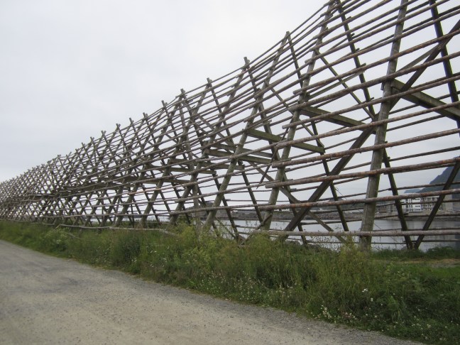
The dried cod is called Stockfish. The fishing and drying goes back to ancient times. The availability of stockfish enabled the Vikings to have nutritious lightweight and long-lasting provisions for their voyages. Stockfish appear on the Bergen coat of arms! Italy is a large importer. And ground meal from cod heads and guts goes to Nigeria.
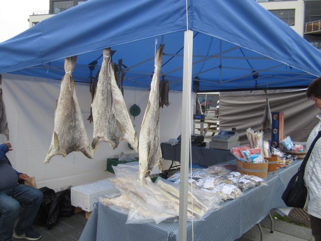
Stockfish on sale at the daily tourist market in Svolvær.
With the rise of oil and gas, there was more money in Norway for infrastructure in the last 20 years or so. The closer islands are now all joined by bridges (although some close in bad weather) and the main roads have been sealed.
Tourism is becoming a more important part of the economy – if I understood Eric correctly, there is apparently a proposal for a 50 storey hotel in Svolvær. (I wonder if he said 15? Even that would be out of proportion.
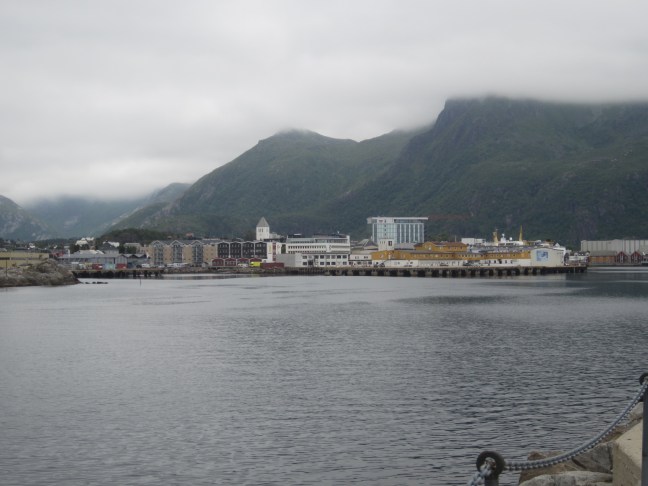
There are 4700 population in S – hard to find where they do their shopping. I found the supermarket in passing, and then had real trouble finding it again when I decided to visit.
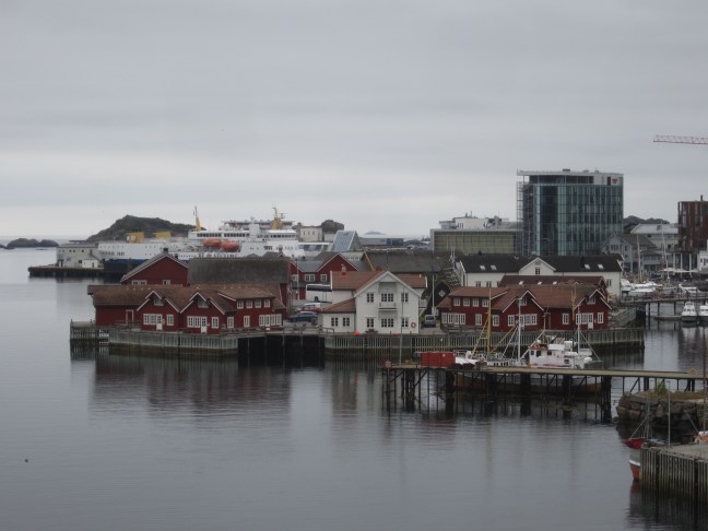
I hired a bike on Saturday afternoon to explore a bit more widely around the town and down to the next one. When all travel was by boat, it was no inconvenience to make settlement on small islands, and away from the threat of rocky avalanches from the nearby mountains. The original settlement at Svolvær was on two long narrow islands which form the eastern side of the harbour. Now mainly holiday accommodation, but still some fishing industry including a large plant that washes nets – with cranes to help dry the nets.

There is a high bridge linking the main island to these smaller ones – here looking back to the small island with my hotel (reception is in the white building, I had half the red building immediately to the right). The taller buildings in the town centre can be seen beyond on the right. A local ship in port. Quite a lot of local water traffic in addition to the daily Hurtigruten ships (one northwards, one southwards in the early evenings.)
Then on Sunday afternoon I took a RIB (Rigid Inflatable Boat) ride up the coast to a narrow fjord (Trollfjord) with a small hydro-electric power station, and finding sea eagles along the way.
Apparently the ice-age ice sheet which totally covered the mainland (hence no tall mountains and rounded scenery), was only 40 m thick through this area. So the Lofoten (pronounced luffutn) islands have this unique scenery of jagged mountain tops but smoother fjordland lower down. (I don’t have a good photo – kept being most obvious when I was on the move, or tops were covered in cloud.)

Apparently this house was built in 1850. Only has access by boat, or a 20 hour walk over the mountains.

I have had to get out the atlas to find these places. What an adventure! Even if you haven’t done exactly what you signed up for!
LikeLike