So for those who are interested, here is a bit more detail on the MTBO in the first 3 days.
On Day 1 and 2, the arena/assembly area was the same: MTBO to the west and runners to the east, then swap on Day 2 so no mixing of bikes and runners.
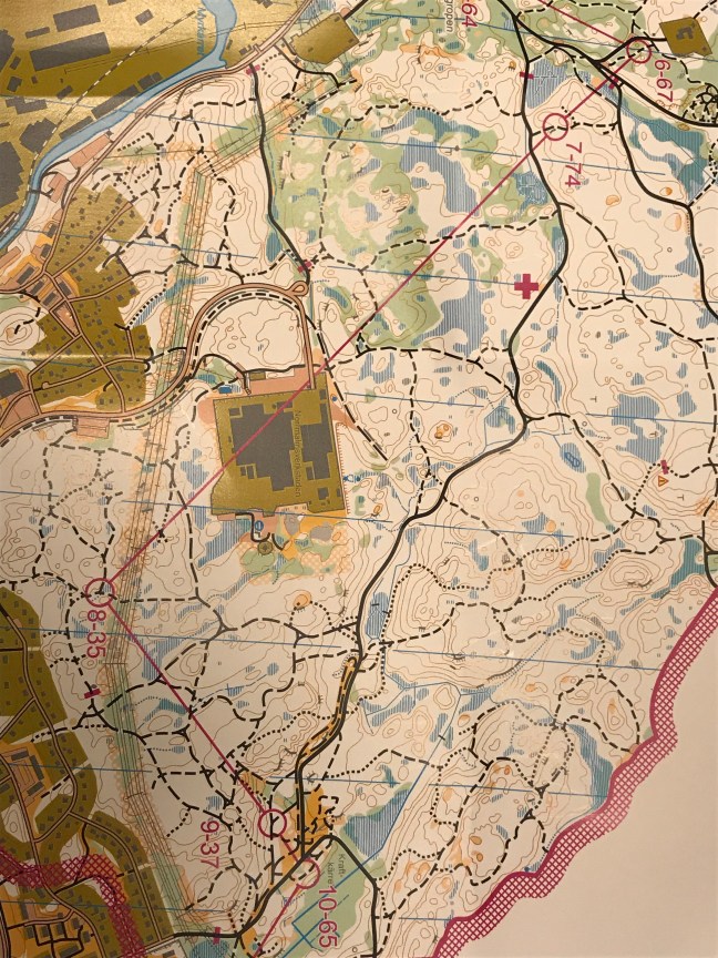
DAY 1: Some steeper sections thanDay 2. I started well on my 5.4 km middle distance course but after a long fast road section and a steep climb to the plateau from #7 to 8, I lost concentration and thought I was further along the track than I really was. Much confusion – to and fro: where is this side track? I lost close to 20 min on that leg.
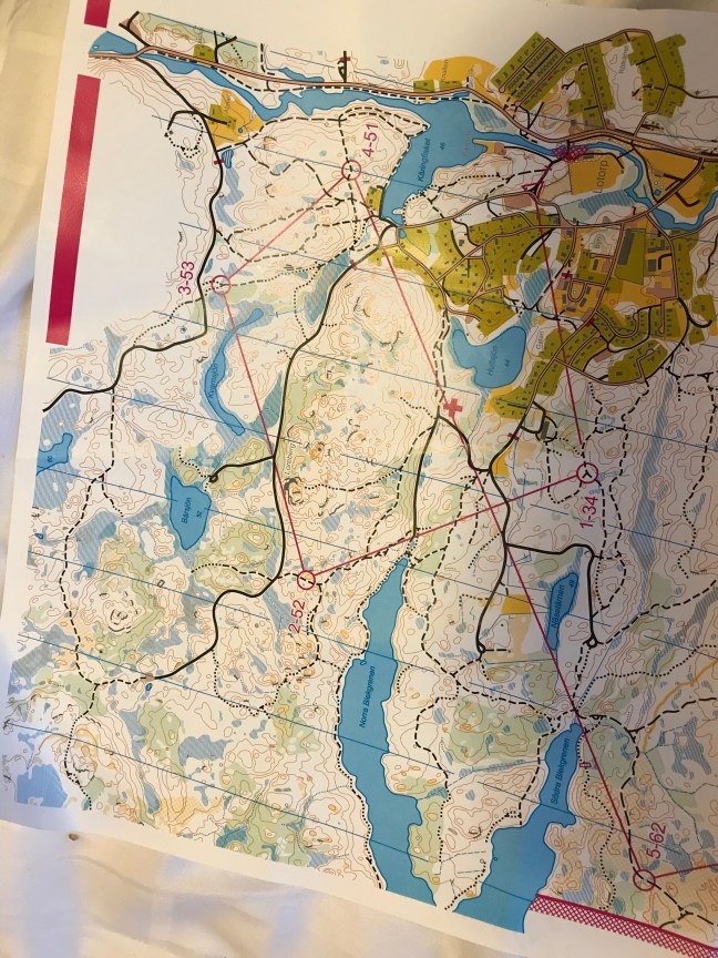
 DAY 2: A ‘long distance ‘ event – the essence is route choice. Advertised as 8.5km (shortest feasible route). The tracks (black lines) are graded according to how fast the mapper reckons a top rider (ie not me!) can ride. Solid line = fast; long dashes = pretty good; short dashes = slower; dots= very slow, might have to carry your bike.
i found I often had to walk on short dash tracks. Took Nearly 30 min to #2 (this could take me all day). Things got better after that – I started to take wide route choices to pick faster tracks.
i reckon #2-3 is the leg of the day. How would you do that?
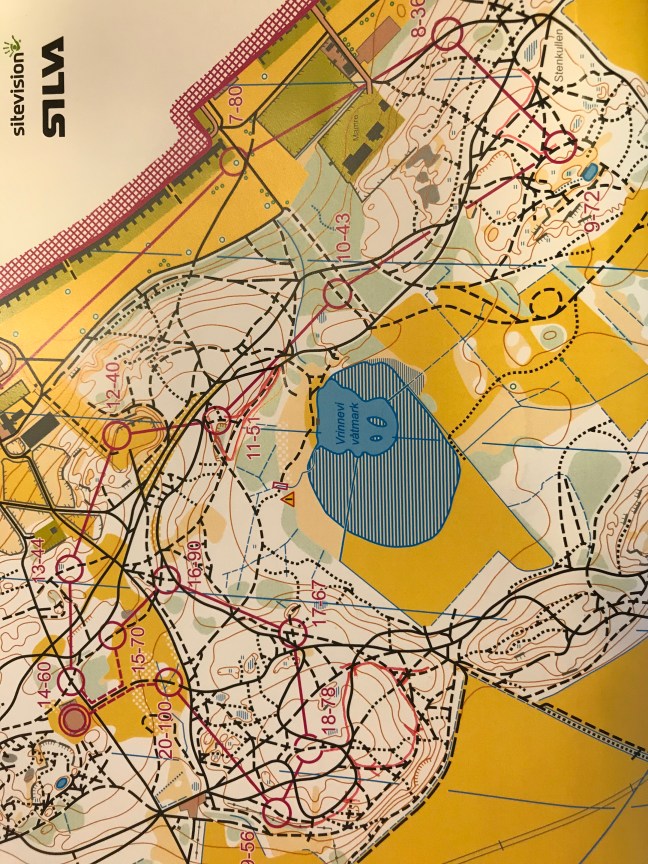
 DAY 3: Middle Distance, Sprint style. Lovely forest and recreation area right in the edge of town. Most tracks rideable for me. Just MTBO today. The foot people had a rest day. We get our rest tomorrow. The map scale was 1:6000 and the track junctions were sometimes closer on the ground than they seemed on the map. That tripped me up #4-5 and then going to #9 and then 11.
But the big error of the day was 18-19. I did a mental 180 coming out of 18 and took a fair while to sort myself out. (I unusually I have marked my mistake routes on the map in red.) Took 70min should have been closer to 48!