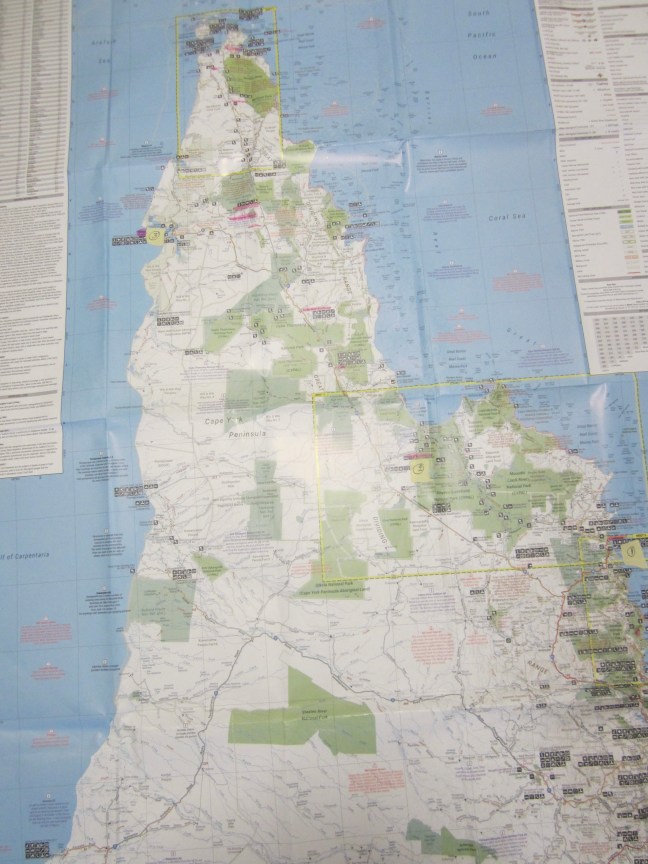
My big Hema Cape York map is a marvel. It has insets for the parts where more detail is needed. The Port Douglas to Cooktown section is @ 1:250,000. Then we did Cooktown to Laura and Lotusbird Lodge/Musgrave is @ 1:700,000. And now we are onto the less detailed section to Weipa and across to Moreton telegraph Station tomorrow using the full map @ 1:1,100,000. On Thursday as we move north of Moreton TS towards the Tip, we’re back on 1:250,000.
On the map shown here, I have marked 3 locations with yellow numbered squares: (1) is Cooktown. (2) Is Lotusbird Lodge – south of Princess Charlotte Bay. (3) is Weipa. Impressive how far we have travelled in 3 days with just 2 days of driving. Moreton Telegraph Station is in the pink shading east of Weipa.