Grumpy Kathy

Bergen is a pretty city. Very photogenic – though the extremes of light and shade make it difficult to take good photos.

It’s just hard to get around. Grumpy Kathy is coming to the fore! Having just come from Oslo with an excellent map of the city provided to tourists – clear street labels (on map and ground), public transport routes and stops marked. Easy.

Bergen on the other hand provides a map that needs to be a larger scale. Street labels so small and fine-lettered that they are almost impossible to read even with the good glasses, and the map is a jumble of numbers and letters to direct you to points of interest (But you can’t actually read the names of the streets they are on!)

I visited the woods and parks on top of the adjacent mountain. No map available beyond the playground and BBQs, but there were signs to the lake. We’re encouraged to walk. Other signs too, to hiking destinations – but where are they? Is it possible to do a round trip walk to the lake and back to the cafe etc? I started out but got too worried I’d end up miles away. Retreat was the only option.

I hung about waiting for the Activity Centre to open. Perhaps they would have maps? Looking at the one on the counter there it seems I could have done a loop via the lake. Most dissatisfying. Why not signs? Map display?

So I’ll walk back down through the nice forest and look at the nice views and take more photos of white timber houses with orange roofs and hope for less (and fewer) cross-making day’s to come.

That’s if I can find the recommended bus stop for the airport bus tomorrow – the map is not clear! Buses are supposed to go every 15 minutes, but at my nearest stop it only goes once an hour. I check the website. The stops (with times etc) are listed by name – but no indication exactly where each is compared with the stops on the map. Sigh!

Bergen

The enduring visual of Bergen is the set of old, coloured wooden buildings in the area known as Bryggen – translates as “wharf”. The first buildings in Bergen were along the waterfront here in the 12th century. Of course timber buildings are always at risk and the great fire of 1702 destroyed the whole town. These buildings have been rebuilt and restored many times on the same footprint, and are now preserved under UNESCO World Heritage.

Bryggen was a key Centre for the German Hanseatic League for around 400 years (But I didn’t go to the museum.)

My hotel is less than a block from this labyrinth of narrow timber walkways and old buildings. Just a small area but fascinating. Mainly artisans, artists, jewellers – but also the regular tourist fare and clothing.

There is real ‘city’ stuff on the other side of this part of the harbour but I haven’t spent much time over there. And I’ve decided no museums.

This morning I was up early (as advised by B and B) to catch the funicular up the mountain immediately north of the city (7 low mountains ring Bergen). I was dismayed to find low cloud down to the houses halfway up the slope, but persevered. And at the top, glorious sunshine and just the tops of the surrounding mountains visible.

So I walked to the lake. (Artificial – an old mill pond).

But before I got there, I was surprised to find an O marker. (Apparently part of an online regaining-type course that extends across the city.)

By 10am the cloud had burnt off and I walked back down.

Forests, Hills and Valleys. Take 2.

Well that wasn’t a good start to today’s blogging. First I couldn’t get most of the photos to load properly. Then I couldn’t find the edit button. Then I managed to delete the whole blog instead of one of the failed photos! Let’s try that one more time.

I liked Flåm even if I didn’t get to ride the famous railway. I did watch a video of the train trip at the railway museum and learnt a bit about the construction and the prosperity it has brought this valley in tourist kroner.

I stayed at the Fretheim Hotel which preceded the railway by quite a long time. And you can see the different styles of architecture. My room was in the boxy section with balconies.

My room looked fairly old on the inside but clearly not in the oldest section. However my leather desk chair wouldn’t have been out of place in Amundsen’s cabin on the Fram.

So we left by slow boat, down the fairly wide fjord and then up the adjacent Nærøyfjord (which I suspect translates to something like Narrow Fjord). Lots of high thin waterfalls. Occasional small villages. Kayakers camping and touring. Hikers who have come over the mountains. To Gudvangen at the head of the N Fjord: bus stops and camping/caravan parks – at least that’s all I saw.

Our appointed bus also seemed to be the local bus and were hailed down by a handful of people, not necessarily at designated stops. So when we deviated to Stalheim, I assumed it was to another pickup. But we continued over the top and down the narrow, steep road with 12 or so tight switchbacks, to check out the scenery.

And so to Voss with 2 hours to wait for our Bergen train. A sizeable town. Can we leave our bags at the station? But there is a Bergen train there about to leave. One guy asked the conductor if this is outer train. No, but there is lots of space so we can get on. About a dozen of us piled on and the train left. So 2 hours early in Bergen and didn’t see much of Voss. (But there wasn’t any evidence of Left Luggage space.)

Not Quite the Planned Itinerary

Got away on time from Oslo with a fully booked train. The conductor only seemed to be checking every second ticket – fully booked and no one complaining someone was in their seat: we must all have tickets!

Initially mixed coniferous forest with occasional small lakes and what looked like holiday cottages. Further from Oslo, the country opens up a bit for farming. We seemed to be on time when we arrived at Gol at 11:30. But there we sat. The announcements were hard to hear and reasons for the delay unclear. Seemed there was a block up ahead and something about a Diesel engine. An hour later someone had interrogated one of the conductors. Seemed there was a power failure further ahead. I guess we are an electric train. So we’re the ones needing the diesel.

But Wait! There are 2 replacement buses going to Flåm. (Lots of grumbling about needing to meet the cruise ferry out of Flåm. But that’s where my accommodation is tonight!) And 2 buses won’t go very far for a full train. I’m first onto the first bus! 2 1/4 hours drive though some interesting country. Tall forests are long left behind. Now higher. Low bushes and grass. Holiday camps, waterfalls, fast flowing shallow and rocky streams, ski places ( nothing big enough to call a ‘Resort’), patches of snow on the higher peaks each side of the valley. And some winding roads until finally the (2 lane) E16 which featured tunnels. The longest 25km, apparently the longest in Norway.

So I missed my ride on the Flåm Railway. David will not be pleased. I made a bit of an effort to get on an afternoon train, but no seats. And considered a quick return trip early tomorrow – but I don’t need to spend another $100 and there will be many more valleys and fjords and mountains.

Instead I went for a walk and climbed up a long way to a nearby waterfall (Brekkefossen). I’m not as fit as I was in the Kimberley last year!

From the road below:

From the recommended vantage point:

And then the sheep with bells, and water patterns behind them.

And good views. One of the cruise ships is heading out. The tourist centre by the fjord is hidden behind the green spur in this photo.

I’m in an old previously elegant hotel right on the Front. This photo, this afternoon with the two cruise ships towering over the centre of the village. View from my 2nd floor balcony.

Museums in Oslo

I’m not a museum person. But when I was planning these days the Viking Museum caught my eye and I booked in advance for today.

There are 6 museums on Bygdøy, a peninsula (almost an island) just south of the CBD. Access by bus #30 or ferry. Look for the “museums ferry” at Pier 3.

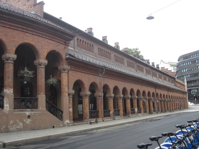
So I headed in that direction and found a fortress – tall stone walls surrounding a hill just SE of the central area. And discovered free entry – let’s check it out. Looks like a great area for a foot sprint with different levels and several tunnel exits to tracks and terraces outside the walls. (The guy in the Info centre doesn’t know of any O here. )

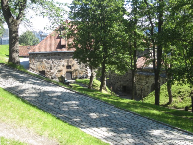
The Akershus Fortress. The castle was completed around 1300. The kings lived here and remodelled and extended the castle in the early 1600s. The royal family have moved out but still maintain an interest – I happened to see the changing of the guard this morning – soldiers of the Royal Guard with plumed helmets. It continues as a military establishment (Norwegian Defence Force Academy is here) but no fortifications for 200 years.

There is also the Resistance Museum which I checked out, thinking to learn more of Norway’s WW2 history but I’m only mildly more informed after most of the detail was in Norwegian.

All that reminds me … the minimum age for Seniors discounts is 67. I’m clearly looking my age. On several occasions I’ve been offered a seniors rate straight off, and no one wants evidence!

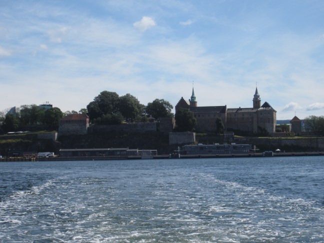
So eventually to the ferry. (And looking back, there is the Akershus castle and fortress.)

A bit of an uphill walk to the Viking Museum. They have 2 pretty much complete Viking ships built around 900 AD and one missing its superstructure. They are 20m+ in length and 5m wide with positions for 24-32 oarsman (depends on the length – they vary. Two of these three would probably have been able to travel as far afield as Iceland.

These still exist because they were used for burials (sort of like the pyramids) with food and household items, and jewellery and sometimes animals. And then a huge mound of earth placed on top. These 3 were unearthed in the period 1860-1910).

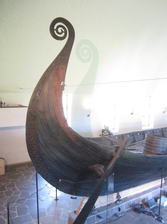
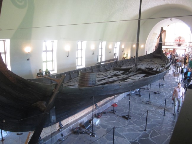
I was a bit disappointed. Would have liked to learn more about the Vikings and their activities – focus was mainly on the deaths and artefacts remaining after the grave robbers had done this rounds.

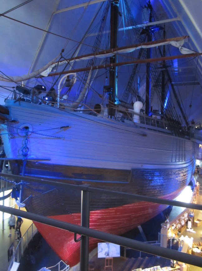
One other museum had meanwhile taken my interest. So a short bus ride to the next group of three, to the Fram Museum. The Fram was Ronald Amundsen’s ship on his South Pole trip, and had also been involved in Arctic exploration.

Two triangular-shaped buildings joined by an underground gallery. The first building focussed on Antarctic exploration. (Amundsen won. Scott did not.). Excellent signage with lots of detail around the perimeter on 3 floors – and in the centre of the building is The Fram, beautifully restored. You can go on board and explore below decks to see how the expeditioners lived and worked and how the ship was loaded. ( the original specifications: strong enough to withstand ice pressure, big enough for 12 men and 5-6 years of supplies!

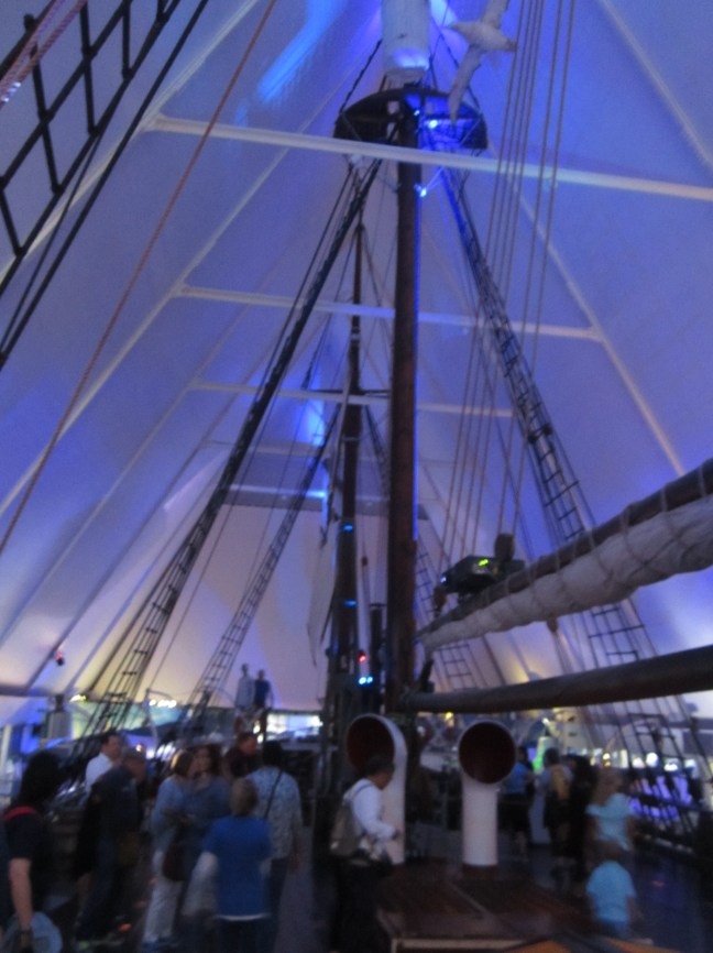
I was ready to go when I was enticed by a sign for movies. I could do with sitting down. And Oh My! I’d forgotten there is a second ship here ( in the next building). The Gyøa was the first ship through the NW passage north of Canada. This whole pavilion is devoted to Arctic exploration.

No. I’ve had enough. I’ll buy a book on the way out. But the books are all too heavy and too detailed. I just wanted the simple version.

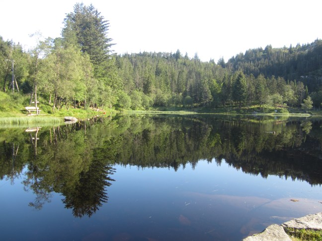
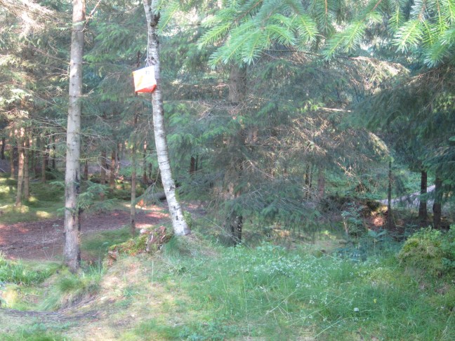
So the last part of the day’s plan was a walk in the woods. Back on the bust to the S side of the peninsula.walk down here … no not there. The signs are warning of the nudist beach. And the grassy foreshore is well populated. Finally on the right track – could do an interesting MYBO Sprint in here. Very pleasant and not too open forest. Around 3 km later I managed to find the main road and a bus stop to come back to town.

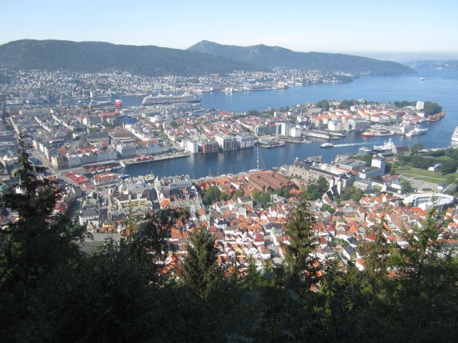
I forget the Norwegian. But I’m pretty sure it would translate as Paradise Beach. the buildings in the distance are west of the city centre.

Now packed and ready to move on tomorrow morning, Flåm tomorrow night.

A Sunday Stroll in Oslo

Once upon a time I would have come off the plane and immediately gone for a long brisk walk.

By the time I’d got me and my 40kg of bike bag and backpack weighed down with more bike gear from the airport baggage return to train, and from central station to my nearby hotel (with detour because I didn’t understand what google maps was telling me) I was pooped! But after a few jobs and short snooze it was still only 11:30am so nothing for it but a walk! But very leisurely.

I’d been told that Oslo is pretty quiet on Sundays. Most shops aren’t open. But the promise of 20deg later in the day brought out the crowds. By 2:30 the drizzle had stopped and sun trying to poke through. By 4:30 it was quite hot in the sun. Why didn’t I bring my hat out? Lots of coffee and kerbside eating places. People on the streets and parks. Large tubs of summer flowers along Karl Johan Gate, all overlooked by the royal palace at the top of the hill.

Lots of usage of the electric hire scooters that I’d seen for the first time in Adelaide last week. Helmets not required here,

Interesting old cloisters behind the cathedral. Now used by a cafe.

Eventually I took to the trams and rode the 13 line from end to end. Heading west from the CBD is a neighbourhood of fine late 19th century dwellings, now many used for embassies. Further west the line climbs, turns off the roads onto what look like old railway tracks. More trees, narrow winding suburban roads.

In the other direction heading north of town almost immediately old-style 3 and 4 storey apartment blocks. Then as the land rises, newer apartment buildings.

No high rise in the centre of town. Redevelopment means refurbishment.

And finally a stroll along the Akerselva stream. Reminded me very much of Denver, Colorado.

Ready, Set …

Not yet quite ‘go’. Again this is a practice to remind me how the blog works before I head off again. Already the software has wanted me to load a new app. Hopefully it will work ok.

The plan is to leave on 6 July to Oslo. Again with the bike. Leave the bike in the hotel for 10 days while I follow the tourist trail in Norway, then Sweden and Denmark for some MTBO ( mountain bike orienteering). Home again on 6 August.

So now a photo practice …

We’ve got new club bike jerseys. But I can’t figure out how to turn the photo.

Art 7 – Patchewollock

Brisbane artist Fintan Magee lived in the local pub to get to know the locals and found a local sheep and grain farmer with their he right height and leanness tomfit the narrow 35m high canvas. Completed in late 2016, the archetypal Aussie farmer.

E16EB2F8-D3C4-46F0-98F8-B770D3042832

23D81299-CA63-4E7E-A2CF-87843D4150AA

There is more silo art further east – four sites north of Benalla. They will have to wait for another day.

Art 6 – Lascelles

Melbourne-based artist, Rone depicts a local farming couple – part of a family that has lived and farmed in the area for four generations. They are depicted as nurturing the town’s future with their vast farming experience and longstanding connection to the area. Completed in mid 2017, he used a muted pallet to produce a ghostly transparent effect.

These are different in that they can’t be viewed together. They are on opposite sides of the separate silos.