Faraway Bay

This tour had two options. After the Mitchell Plateau, return directly to Darwin, or have another 2 nights, at Faraway Bay with advertised fishing and a visit to King George Falls. Well I didn’t care for fishing but this sounded like a good option so I took it. 12 of us (out of 19). That’s all that could fit in this smaller camp. It’s right at the north of WA. Just east of the northernmost point.

This is the first year Outback Spirit has used Faraway Bay, privately owned by a man and wife. They have started running Wet Season tours as well with 2 nights at F Bay and 3 on the Mitchell Plateau. By the time I’d left there, I was thinking I’d like to try a Wet visit…

So we flew into the airstrip on the plateau above the F Bay camp – no accompanying Outback Spirit staff. The owner met us in a 7-seater 4wd. His larger vehicle had ‘died’ so he’ll have to make 2 trips. Half of us to sit at the airstrip under a pop up shelter- camp chairs and an esky with cold drinks provided – for 70 minutes until he got back. It’s 4 km on a VERY rough track.

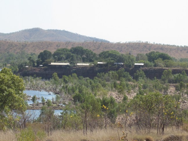
This is a very isolated location. No access by road. The regular supplies come in by small plane. Anything heavier – fuel, machinery, grader to deal with the road, new engine for the back-up generator etc has to come by barge to be offloaded on the beach.

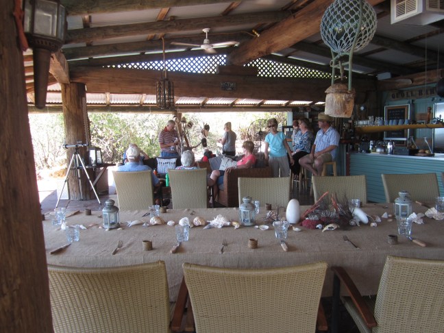
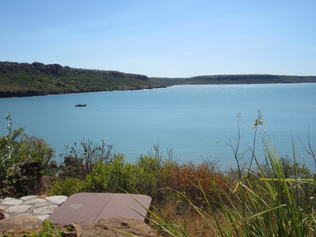
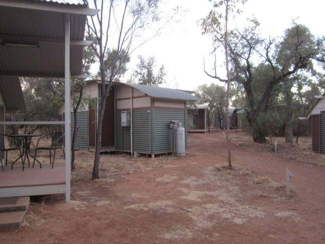
There are 8 small cabins (not much bigger than the bed, poor lighting, not the place to spend non-sleeping time) and a central shelter, open on 3 sides, containing the kitchen, long dining table, and a lounge area seating 6. A couple of other seating areas but outdoors and only one area has partial shade. And a small pool (no beach swimming: crocodiles have recently been sighted). Magnificent views – it’s right on the cliff top.

6123A847-33D6-44E3-A8FF-9C645A689693

0AB573A5-AB81-48B9-9F27-9C8FA772E258

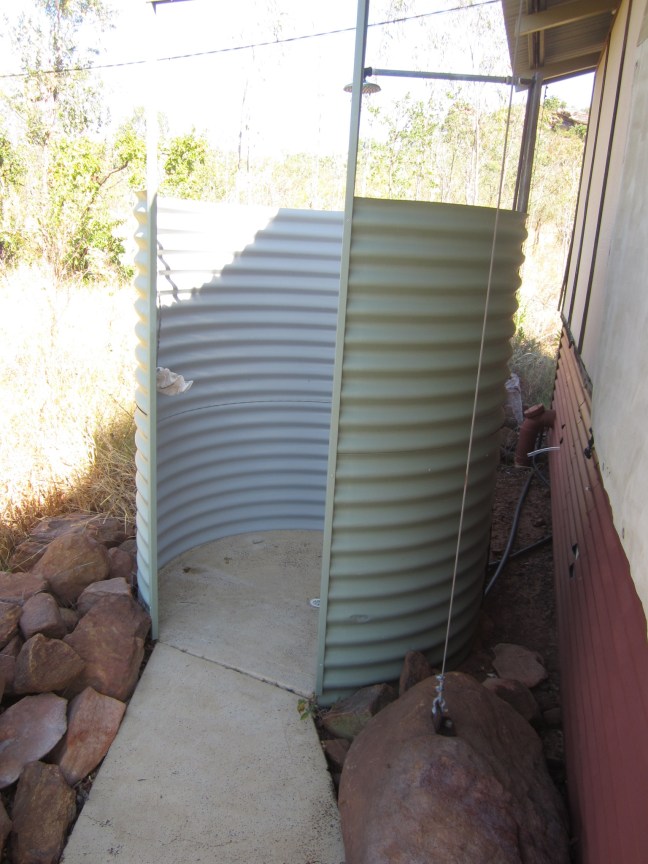
It was described as ‘rustic’ and that’s true. Each cabin had an outside shower with the same view: no door.

2A11C8C3-8E40-48BD-A0B8-B51AE84D3382

on the first night, the generator failed. 5 hours without power or lights over dinner and bedtime. The staff were terrific. 3 travellers, including the chef (great food), and an older chap (jack of all trades). It’s very isolated for them and they apparently get some time off every few weeks in Kununurra, but there seems to be a fairly high turnover.

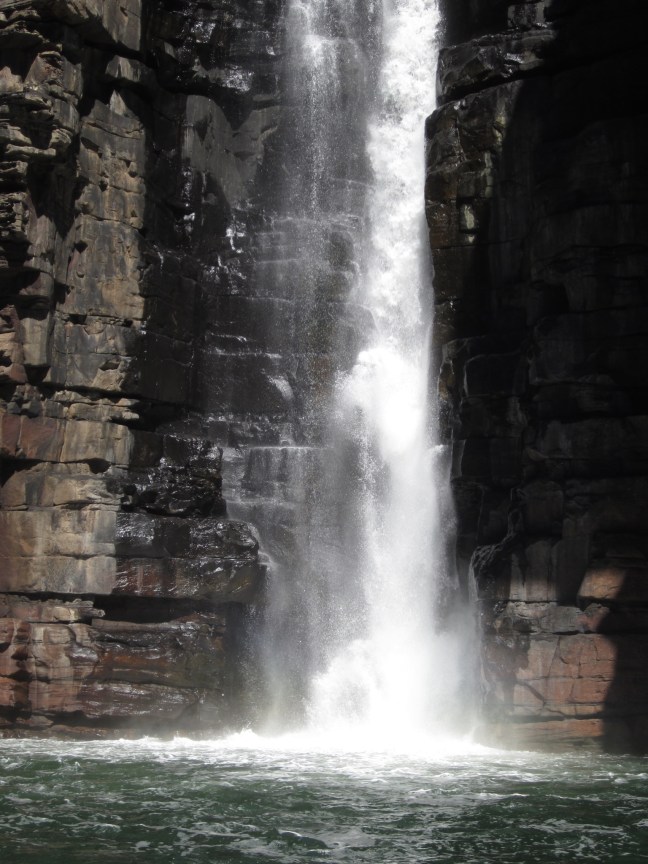
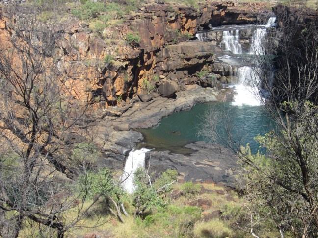
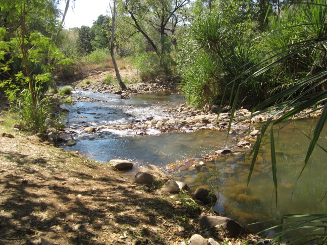
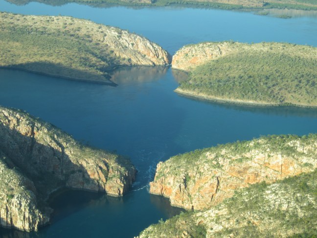
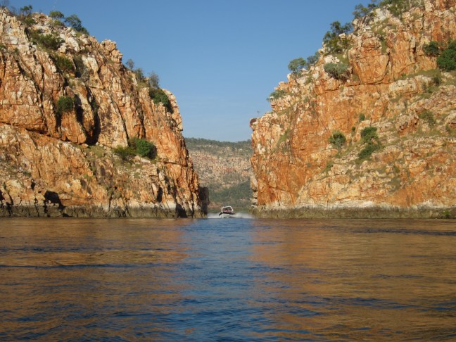
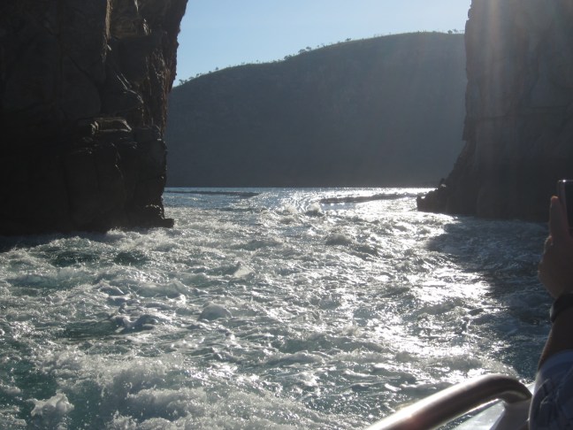
On the full day, we went by jet boat to the King George Falls. About 50 minutes to get to the river, then some slower wandering to look at interesting landforms etc. the owner was very knowledgeable about all this but we missed the good communication, organisation and personal attention that we’d been used to for the rest of the trip.

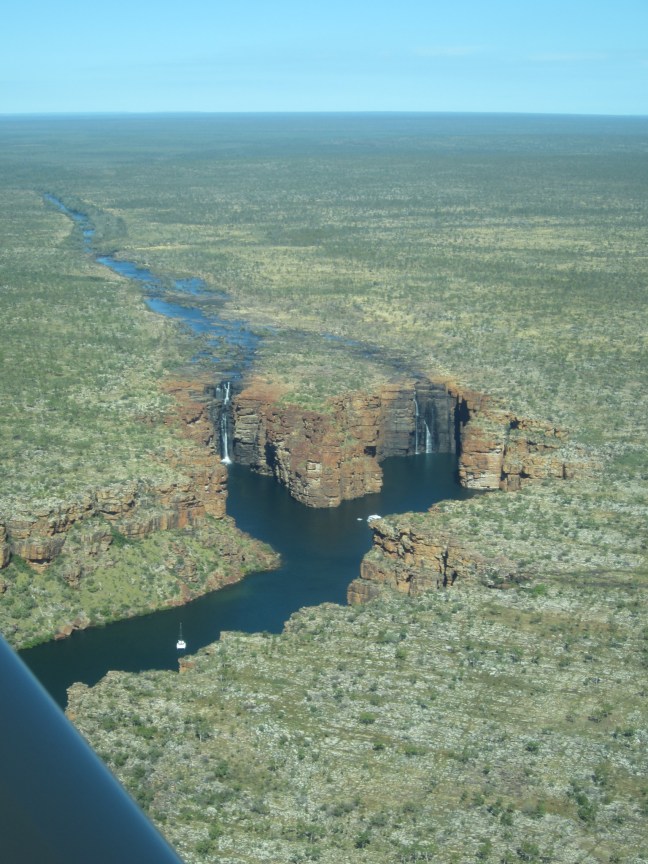
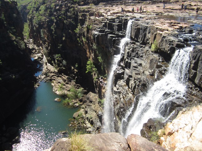
Apparently the twin falls that comprise the King George Falls carry the greatest volume of water of any falls in Australia. From a distance they were a bit disappointing but up close the water is coming over with considerable force. Over 50m high and just as deep as that under the water.

CA383CE9-5A9F-4489-B882-6D7393AB0770

And flying out the next day:

9835610E-F0B5-4CA7-B38D-22F5AA3AEB52


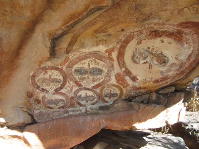
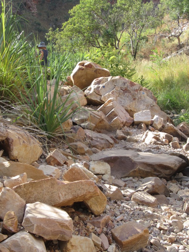
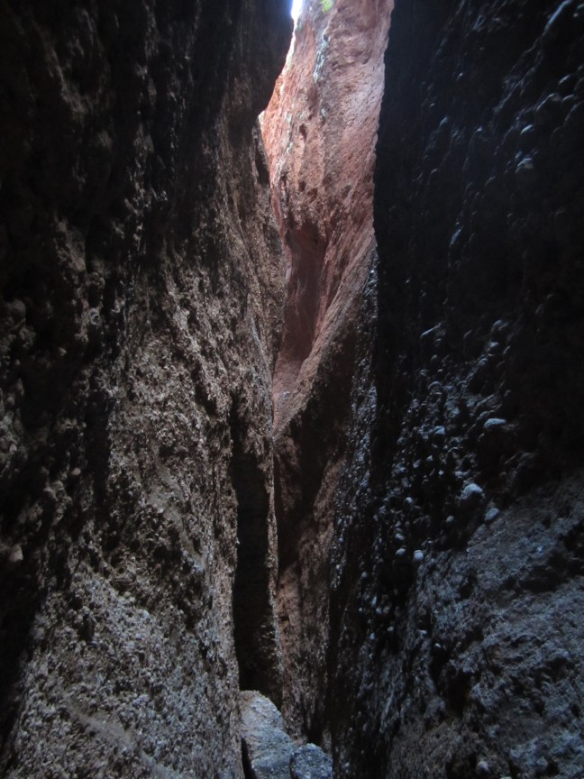
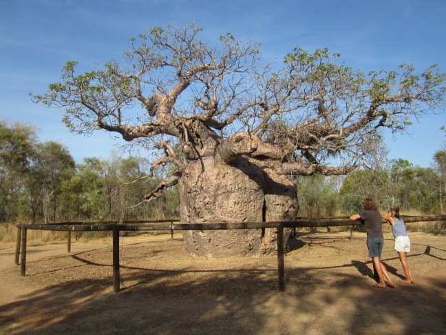
One night I followed the I distinct track up the rocky knoll above the camp – views asnd some rock art.

17C82D75-BF6F-4AB6-A8A0-3B47F1BCBA9A

overall a bit of a disappointing end to the trip. Just not up to the standard we’d been getting. Guess I won’t be doing the Wet season trip.

But we did meet up with our Outback Spirit guide when we got to Darwin and reported back. (He doesn’t usually get to meet groups in Darwin. He had an unusual itinerary this time. ) So our reports on F.Bay will get back!

Mitchell Plateau

Sunday was a long day. 450 km of gradually deteriorating dirt roads from El Questro to our camp on the Mitchell Plateau. Over 9 hours including stops.

The Gibb River Road has quite a good surface (though rough crossing even the small dry watercourses) and not so much traffic despite reports to the contrary. A couple of serious rivers early. The Pentecost seems to be the one to keep an eye on to know if the Gibb is open after the Wet.

59462FDE-1172-405D-8077-867A84F1EDE5

And the distinctive escarpment encircling the Cockburn Range kept us company early on. The sandstone though here is King Leopold Sandstone which includes a lot of siltstone and quartz and breaks down to a very stony surface. Hard-looking country.

After 3 hours we turned onto the Kalumburu Road and it got rougher. Another 2:30 to the turnoff to the NW on the Point Warrender Rd – which isn’t much more than a glorified bulldozed track.  2 hours of that. Not far in there and a stop to check out an area of rock art. Wandjina paintings. The Wandjina are the mythical beings that bring the monsoon rains.  they have no mouth – that might let the rain out prematurely – ah but now I don’t seem to have a photo of one. You’ll have to make do with this one!

C3BDD5F1-9BA1-4F6B-8B5C-5CF89A13AC54

This drive became quite pretty with a forest of Livistonia palms interspersed with the eucalypts. Growing on lateritic basalt which apparently holds water that these palms need to thrive.

575EF34C-3684-4913-9978-AD3BE3C8EC44

So eventually our destination for the next 2 nights. And what accommodation! The most luxurious of the trip. It’s owned and operated by Outback Spirit. Large tented cabins with covered verandas  well spaced. The central building has a large dining room and a covered outdoor lounge area. And a large and deep swimming hole in the creek.

Next morning we drove 20km on rough road to the Mitchell Falls trailhead, with 4 staff from the camp. Half the group chose to take the helicopter down while the rest of us walked the 4 km down to the river and falls. Our guide from the camp was very knowledgeable about the plants and aboriginal lore. Some more rock art and a burial ground. The track was fairly rough and only partly shaded. The last section quite hot. By the time we reached the rest of our group sitting in meagre shade near the heliport, I was ready to sit and have lunch. Until someone suggested that we should go and look at the falls. Oh yes! That’s why we came!

There were so many other people on the track and at the falls. And only a limited viewing area. I was a bit disappointed. Somehow not the great experience I’d envisaged. But two of us and one of the staff did go for a quick swim in the river and that was fun. And then the highlight was the helicopter ride back with several swoops over the falls for photos.

F4DBE67E-3030-46F6-B8CA-BAE9183F6E49

50F9907A-34F7-41AB-81A5-4782B1076C9B


El Questro: 15-16 June

I have a small window of wifi so will see how it goes. Will probably do the words and add photos as a second step. Currently at Faraway Bay, just east of the northernmost point of WA.  But going back …

The owner of El Questro station back in the 50s decided he wanted a Mexican name. So we got El Questro!

The layout is not what I’d expected. I’d envisaged the homestead and ‘township’ area with campground and accommodation and some of the attractions to be all fairly close together. I’d imagined one could put up a tent and get around pretty much on foot.  Wrong!

We stayed at Emma Gorge Resort – restaurant/bar etc, pool, nice shady gardens, flowing creek, and accom in individual tent ‘cabins’. Permanent tents with a box bathroom attached. Quite comfortable.

From here some of us walked up to the Emma Gorge falls in the afternoon. Billed as the hardest walk of the trip. 1.6 km each way. Track gradually getting rockier as it heads upstream and crossing the creek several times. Follow the blue markers though boulders, cross creek here. Our initial front man couldn’t see blue so I led the way – the best over the terrain. (Our leader brought up at the rear.) the last bit was really rough .climbing over boulders. No semblance of track, and in deep shadow. Finally we arrived at a deep pool and gently flowing waterfall. I couldnt be bothered taking off all the ankle protection to go for a swim, but on our  side of the pool there was a little bit of water coming over so we had a shower on the beach!

the track:

AAF44A34-4601-4959-8185-7A359A2BC08E

At the falls:

66845EB7-C191-4661-B9B3-5F8455FD6C6C

Next morning a visit to Zebedee (warm) Spring. Several km up the road. Rocky steep creek and lots of other people there. Not an attractive proposition. Only one of our group went in.

CD79F876-8AEC-4E3D-883E-4606BD4957FE

Then another several km to the ‘township’ and campground beside the Pentecost River. Only serious 4WDs here! My Forester would have been way out of place

454C2E89-69E0-4EF6-9F67-A0515649E2DD

And another several km to the Chamberlain River and Gorge and a view back to the homestead.

53375F8F-27F9-42AA-9D0B-BCCBA6D90925

So all very spread out but an interesting area.

Kununurra – Ord River

Finally some free wifi today. And some time to catch you up, and to catch me up. Early I decided to check the forecast. When I opened the app it gave me the last place I’d checked – Castlemaine. Forecast max 11! Very glad I’m not there!  33 in Kununurra sounds much more acceptable.

But we still didn’t get a sleep-in. I’m becoming accustomed to 5:20am alarms. First up was a cruise upstream on the Ord River. 55 km roughly to the Argyle Dam. Interesting though not spectacular enough to get out the camera much.

First they built a small dam, not much more than a weir at Kununurra and that started the Ord irrigation scheme in the 1960s. So the first 2/3 upstream is in still water of the Kununurra Dam. The huge Argyle Dam gives long term certainty of water supply and the irrigated area is being expanded.

but it seems that there’s is still no continuity of what the best crops will be.  Initially cotton failed though currently GM cotton is being trialled. Rice failed (magpie geese from NT came in in their thousands to feast on the crops). Not as much fruit and vegetables as initially – too far to transport fresh produce. Sandalwood has been a big crop. 20 years to mature and they’ve just had the first harvest. Apparently the big  owners have recently gone out of business, though still a lot of area under the crop. CSIRO has a research station to find the next crops.  Later today we passed a bit of maize and legumes.   Irrigation process is interesting – individual pipes coming out of the channel to service each furrow.

CB4CB05C-3197-4E36-BEDD-0ABC10B1459F

Hey, I got diverted.  The Argyle Dam wall is clay filled and rock.  No concrete because of the nearby fault line. A small hydro plant at the dam provide some power to Kununurra, Wyndham, and most of the Argyle Diamond mine needs.

475A2D90-AFC8-4D03-9585-F11B4CCC57B7


E53689DE-586A-40AC-8555-6CA6E8B0E88B

So then we visited the old Durack homestead which was relocated from the station site which was flooded by the Dam. They only rescued the outside walls of the old house. And relocated it to near the dam wall. Now a museum.

F7546320-9A5D-4327-98A0-4E397122B244

6F262BA3-C867-4DDB-9967-BBCDE1C4FB5E

FInally a visit to Ivanhoe Crossing, the original crossing place of the Ord. then a causeway was added.Flowing pretty fast  I wouldn’t be keen to try it!

6B203F85-480B-474D-9097-0ED09A9EDB68


53BA0F20-B337-4F86-A5A1-5C193EE55A58Bit of of a break this afternoon before a few hectic days. Might get a report to you from El Questro, but then nothing until mid-late next week.

Outback Spirit Touring

As many of you know, I was a bit anxious about undertaking a group tour. But all is going well. We have the newest bus in the fleet – picked up in Adelaide in March. Airline-style seats with 2 USB ports per seat. 24 passenger seats, 19 on tour so I don’t have to share a space. Efficient air conditioning. Fridge, boiling water, Esky and ice for lunches.

a range of people. I’m probably at the top of the bottom third in ages, and well in the top third of fitness (though my knee was grumpy after the last 2 days of walking). If Lorraine was here she would have sussed out all their stories and histories days ago. Maybe by the end of next week I’ll know a bit more …

we have one staff/driver/guide. But he doesn’t have to cook. He collects take-away lunches for when we are on the road, easy morning/afternoon breaks and all dinners are at our accommodation places. Good food. He does 7 trips this season, all on this itinerary so he knows the conditions and details. Very personable. He reminds me a bit of John C (BG).

The accommodation is good. Only complaint is the variability of pillows!

Outback Spirit has a lot of trips – a very popular one leaves every couple of days, a circular trip Broome to Broome. We’ve often seen other buses. The big white buses are very visible in the Kimberley.

D54B03B2-41AA-4356-9997-6203D169A7D6

FEF37AA0-6836-40A7-BF68-FBC17062E571

Purnululu National Park

Bungle Bungle Range. Highlight of the trip so far. The 53 km road in, and the subsequent park roads, although having some serious corrugations and numerous creek crossings (only one with water at present) was not as bad as I’d expected. I reckon my Forester would get in easily if the conditions were like this.  Though I guess early in the season might be better than later after more traffic.

In the northern end of the park, the rock is conglomerate on a sandstone base. Gorges with tall walls.  We went into Echidna Chasm: starts broad with pandanus-type trees, and gradually narrows. At the top end it’s only 1m wide for some distance, and a couple of ladders to help up a couple of awkward jump-ups.


206C700E-A88B-480E-9F86-2E48E2BEE475

We went from there to our accommodation, a camp owned by Outback Spirit. A simple arrangement but comfortable ensuite cabins and a central eating/relaxing area with small swimming pool (which I tried out next day).

E41D7F0E-AE70-4CA4-B3D3-6AF89D1842A7

The southern part of the Range has much finer-grained sediment which is very fragile. Here are the iconic beehive domes. The dark bands are caused by the presence of Cyanobacteria which grows on sandstone layers where moisture accumulates. (It was a bit like visiting the Grand Canyon -couldn’t stop taking photos.

DB31B11E-9072-4573-90E2-045B3B402292

The walk next morning was into Cathedral Gorge. A sunnier and hotter walk but well worth it. At the end of the Gorge is a high chasm with a waterfall (not running in the Dry) and remnant pool. A fault line also runs through the chasm.

Through the West Kimberley


We headed out of Derby on the Gibb River Road  Most of the country through here is flat  When it’s lower there are fewer trees and usually soggy for a while after the Wet. On slightly higher ground there are trees and shrubs. Cattle country. We turned south for our first stop at Windjana Gorge. All of a sudden a vertical wall of limestone appeared – the Talbot Range rises straight out of the plains.

ADF06BC5-81D6-43EE-89AE-23ABBDE1184E.jpeg

Apparently a long fringing reef ( like the Great Barrier Reef) extended from SE of Fitzroy Crossing in an arc running NW and across to Kununurra. It only comes to the surface around here.

53AC3555-5216-4BA9-91C8-8044185EAF0B

The walking track goes through this narrow gap and into a Gorge with waterhole and basking freshwater crocodiles and tall walls. there is a nice camping ground. I could easily have stayed a few days exploring the area.

8D857B01-1E14-422E-A24E-D0D3EC9E99EC

F3CCD9C2-F029-44C2-99B4-B78BCCFED235

So then we went to Tunnel Creek. We’d been warned that the entrance to the underground tunnel is more awkward this year than usual. Some of the group bailed out, but it wasn’t so bad. The walk through this large cavern with the creek through it was more on soft sand than I’d anticipated. A couple of knee deep creek crossings. Sand in the sandals. And eventually we were through. But the bus was at the other end so we retraced our route.


Then onto Fitzroy Crossing and the Fitzroy River which frequently floods up 14m. Quiescent today.

FBE85CEA-1B05-4A55-9779-23F093820674

But everything nearby is built high, this is our accommodation for tonight.

5ED1C1D9-8262-4885-911C-BA694B2EA796

And to finalise a long day, a quiet cruise on the Fitzroy River at Geiki Gorge. Here the river splits the Oscar and Geiki Ranges. Both very low elevation and limestone. The ‘gorge’ does have Gorge walls but a long way apart. The river only reaches both sides during flood times in the Wet. At it’s narrowest point the walls are probably 400m apart. The white band marks the ‘usual’ high water level in the Wet.


We’re off  to the Bungle Bungles tomorrow. Expect poor internet so probably no update before Wednesday night.

Day 3

This trip is called Jewels of the Kimberley. This morning we ticked off Jewel #1.

A 5:20am pickup, transfer to the airport, and a small seaplane flight for an hour 250km to Talbot Bay and the Horizontal Falls. Two narrow passageways eroded  through two rocky spurs with an enclosed bay behind. 40m deep. The incoming and outgoing tides rush through these passageways. The largest is 20m wide, the smaller is 7m. When the water height differential is more than 1m, it’s deemed too dangerous to take boats through.

7D701A10-B6E0-460D-A05D-C3F1621AD5FB

E7A1D226-E10B-4F63-BBF0-065AC7C23231192EE280-9E22-449A-A1DA-31EFE05F1006

Quite a slick operation. Two large joined houseboats have 3 reception areas to keep the groups separate. Staff live onboard for 12 days then get a break for 3-4 days when the tides aren’t right. Our plane moored and fairly quickly we were whisked off on a jet boat. Several fast passes through each passage interspersed with lingering and looking. Apparently a half metre difference in height today. Lots of dangerous-looking eddies and whirlpools. I decided jet boating is not for me but the phenomenon is interesting.

F3C27DD4-900A-4BC2-B107-0871802E4F99

then back to the houseboat for breakfast. Watch the shark feeding off the pontoon, Tawny Nurse sharks. then a more sedate boat trip up Cyclone Creek where there are two more houseboats owned by the company used for longer group stays. interesting rock formations (Pentecost sandstone) and then the flight back with views down the coast – Buccaneer Archipeligo, Cape Leveque  Have you read Tim Winton’s Dirt Music?

Then the trip proper began  the bus  really isn’t suited to city streets.

76A8A7E4-60DF-4EBD-8407-FCC4E7B496FE

Along the road, the initial scenery was similar country to what we’d just flown over: flat, scrubby, boring. but eventually some cattle (apparently West Kimberley used to be sheep!); termite mounds, boab trees. (The granddaddy of them all outside Derby – some conflicting information as to whether the prisoners were held inside or just chained around the outside.)

9D231AE6-D622-4255-A05B-52A5C37C4DC6


Cable Beach

I haven’t seen it at high tide. There is a very broad expanse of beach with a wide firm tidal area. Vehicles are allowed north of the rocks, but there is only a narrow driveable passage across the rocks. Long queues on Saturday afternoon to wait for vehicles coming the other way.

8C897C4C-5997-4FAB-B59D-DD1B87128EBC
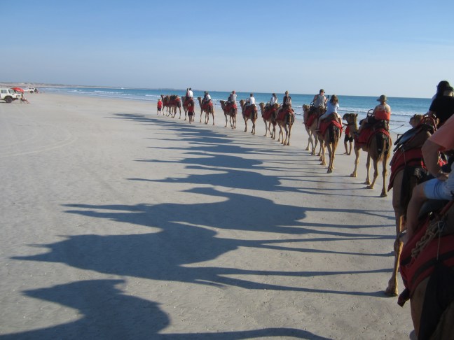
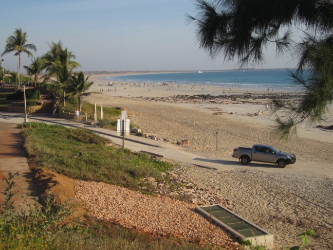
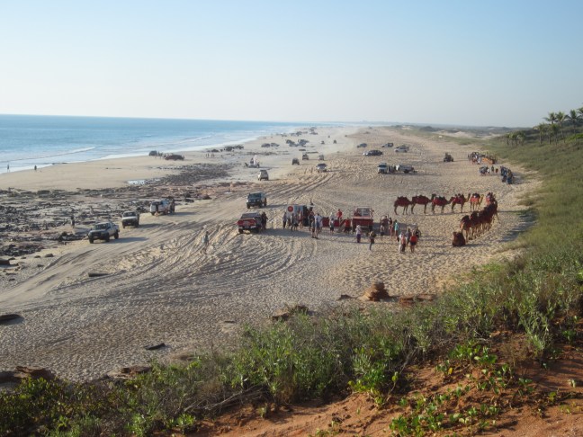
B and B said I had to do a camel ride. So I did. Iconic camels on Cable Beach.  Here’s a selfie:
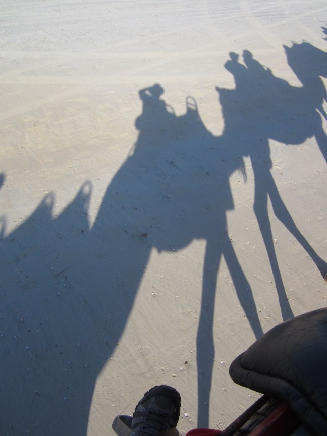
C0B4AF5D-A11B-4BDB-806B-C0A67153215BAnd …

377C97BC-7787-4462-BFA4-7F0BE7F0963C

It’s 5 km from here to Gantheaume Point to the south.

F64DA33C-DC6A-4C59-A4C3-CB7D4BF8FBE4

And. Very busy before sunset on the beach to the north.

FEE20643-0575-488D-A5F0-302A632B7A4A

and of course the sunset over Cable Beach is not to be missed. This lot saw it.

3C9CB83A-08B8-4AE1-9EC4-3DECFD071BFC

Going… going …