I like to reassure my readers that I did indeed get home safely. The weather in Melbourne wasn’t actually too bad when I arrived yesterday afternoon, but it’s been proper winter today. Hmm. Maybe I should have stayed another week. I usually reckon that coming home in August isn’t too bad – the days are starting to get longer then.
but here I am surrounded with damp clothes – one of the wet items didn’t get put in the dry bag in the case! the main problem when I got here was the TV didn’t want to make any noise. But got a tv service guy tonight so now all good.
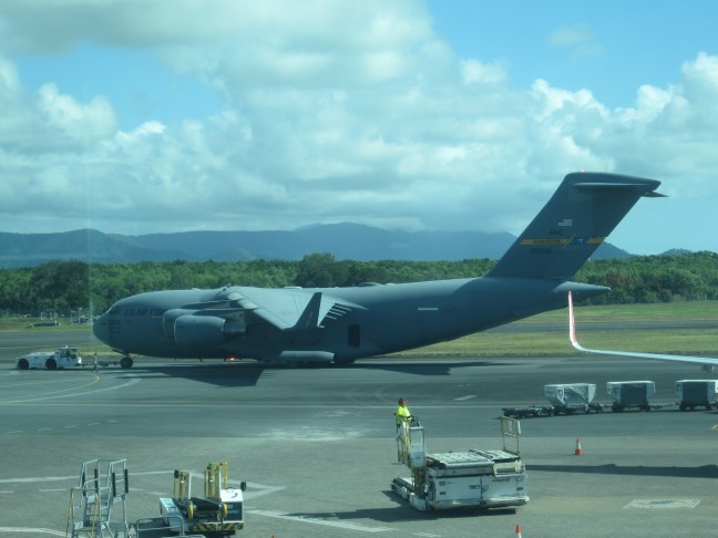
I’ll leave you with one last photo. This Big Boy and its mate were being towed around Cairns airport as we were waiting to load. Is the USA finally invading? Certainly had a menacing look.
I’m wondering if you can see all the blogs. When I log in they aren’t all there on display as I expect. I think this is the 4th one since Pajinka. (If you search by month you should be able to see all in the list?)
I discovered in the last couple of days that it’s not easy to become de-institutionalised. When I eventually got to my room at Cairns Colonial Resort on Monday afternoon (I had checked in but room not yet ready so I’d wandered off and done other stuff) – my bag wasn’t there. (For the last 2 weeks our crew has organised to get our bags to the rooms.) and then last night I looked at my watch – how long before dinner? Oh, of course, no one has told me what time to be there…
But here I am at the airport. Weeks ago my ticketing info had said I was going to Terminal 2 in Melbourne. That’s the international terminal. So I knew it was an international flight. But didn’t give it much more thought. But yesterday, wasn’t able to check in online. “Go to the desk.” And then in the middle of the night, a text: go to the international terminal, check in closes 60 min before flight departure. (And it took so long the other day for the taxi to arrive at the hotel, I was out of bed at the crack of dawn. Too many deadlines and uncertainties. As it turned out, the taxi got there quickly and the only hold up has been with my book in name (the Qantas app has me as Kathy, my ID docs are as Kathryn). Much confusion.
but now I have some time to spare. Maybe the last blog will get done before I leave?
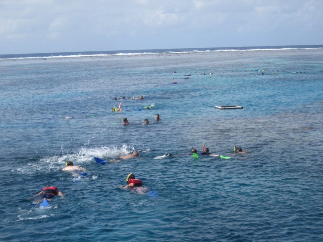
Tuesday was wet. I’d gone to central area for a massage ( booked on Monday afternoon I’d passed a reasonable looking place on a town walk) and caught the bus back. Got very wet walking back from the bus stop. So no swimming. (I’d had my eye on Pool #3 – smaller and a bit more exclusive than the other 2.) Wednesday I’d booked a reef trip. All the reef trip companies share a large terminal near the docks so that was convenient. We visited the outer reef. 90 min from Cairns. Apparently 70 nautical miles (whatever that is – forgot to check) out from Cairns and 50 nm directly out from Port Douglas. I had signed up for snorkelling. Done it before without problems. Some were doing scuba. Probably over 100 of us in the water at any time. They had an area roped off – don’t go in front of the boat, so the lookout has a reasonable view at least of what the snorkellers are doing. Lots of colourful fish – I liked the yellow ones best: two sorts, one with a large black spot on bright yellow, the other with 3? Black stripes. Always in pairs. Perhaps 25cm in length. But there were iridescent blues and greens (sometimes both colours on the same biggish fish) and some camouflaged black and tan. Sufficient colour in the coral to make it interesting but usually only as coloured tips rather than whole coloured ‘branches’.
We visited two dive sites. At the second (perhaps the tide was now further out?) the reef was very close to the surface and sometimes out of the water, so we were restricted to swimming round the side. No touching or walking on the reef! Maybe better fish here?
I had a bit of trouble with my face mask. A different design to what I’d previously used, and water leaked into the nose shape. Put me off a bit and a bit awkward clearing it. I probably didn’t stay in quite as long as I might have, but all interesting enough. In the end I just paddled around in the warm water and didn’t bother about the mask/snorkel.
and yesterday was finally a sunny day. Yippee. I got back to the hotel about 5. Put the wet togs back on, and went off to find Pool #3. Finally got there. So the holiday must be over.
Now what about some photos? I think I loaded them up last night. I expect most are self explanatory.
that’s the outer edge of the reef where the waves are breaking.
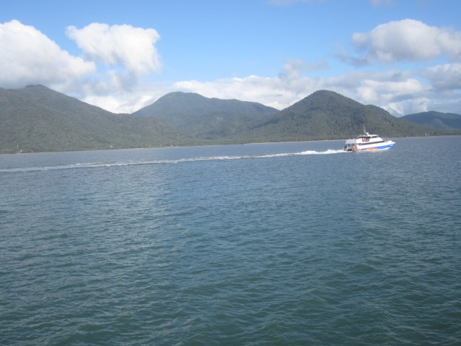
and coming back into Cairns
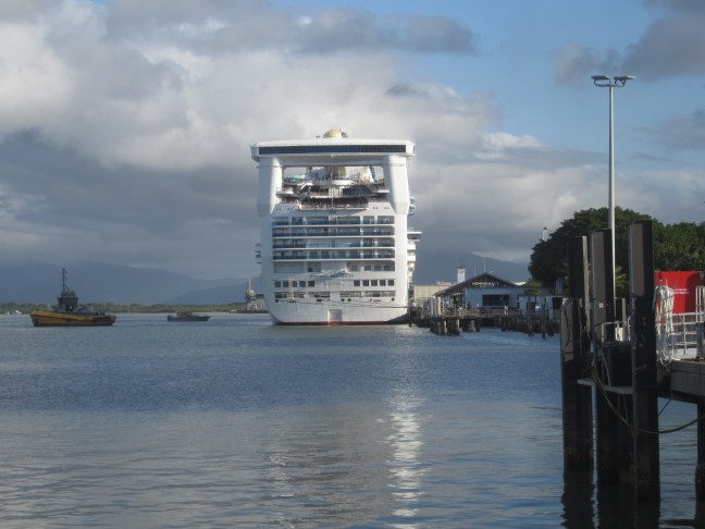
And when we got to out berth, there was this much larger ship over there – a cruise ship of the Carnival line, towering over everything.
The word is, we’ve travelled 1800 km in the bus. Now farewelled the crew off for their next (repeat) trip and I’m settled back into the Cairns Colonial Club Resort where I started this blog 2 weeks ago.
just reviewing some topics I had planned to mention and found some photos that probably should have got included. So a random bunch in no particular order,
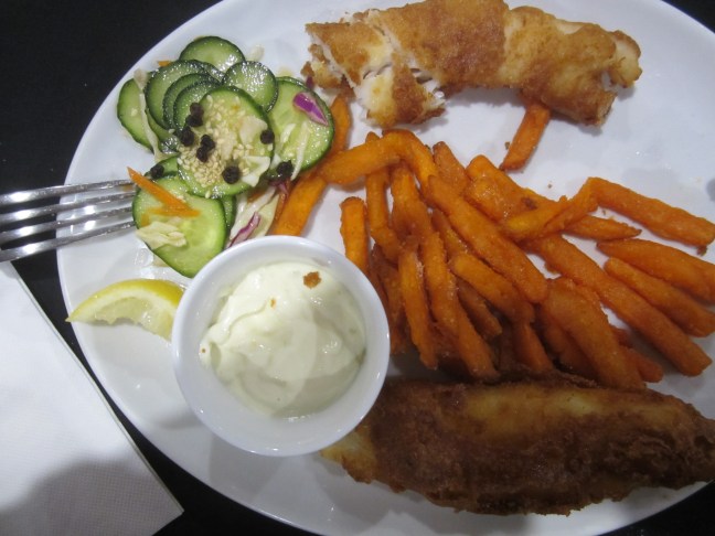
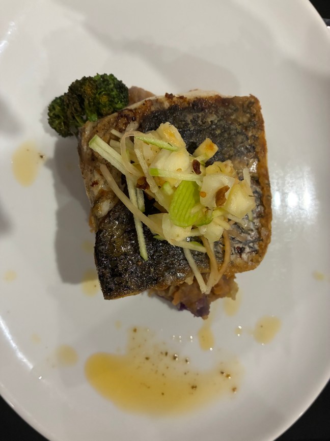
The food was great. Sometimes I thought I should take a photo of the plate but I’d usually taken a mouthful before remembering. One highlight that didn’t get a photo was our remote lunches. (Catered lunches often provided too much on the plate for me at lunch time. ‘Debbie’ (our assistant director) lunches were set up on a portable table beside the bus miles from anywhere. A selection of breads/rolls (I always went for the flat bread) with sliced meats, salad items, condiments etc. Take as much or as little as you want. Come back for seconds. Always plenty. What was left was usually distributed to strangers in the parking area to top up their stores. Always much appreciated.)
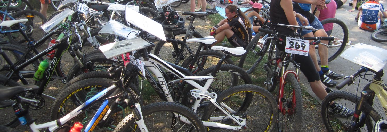
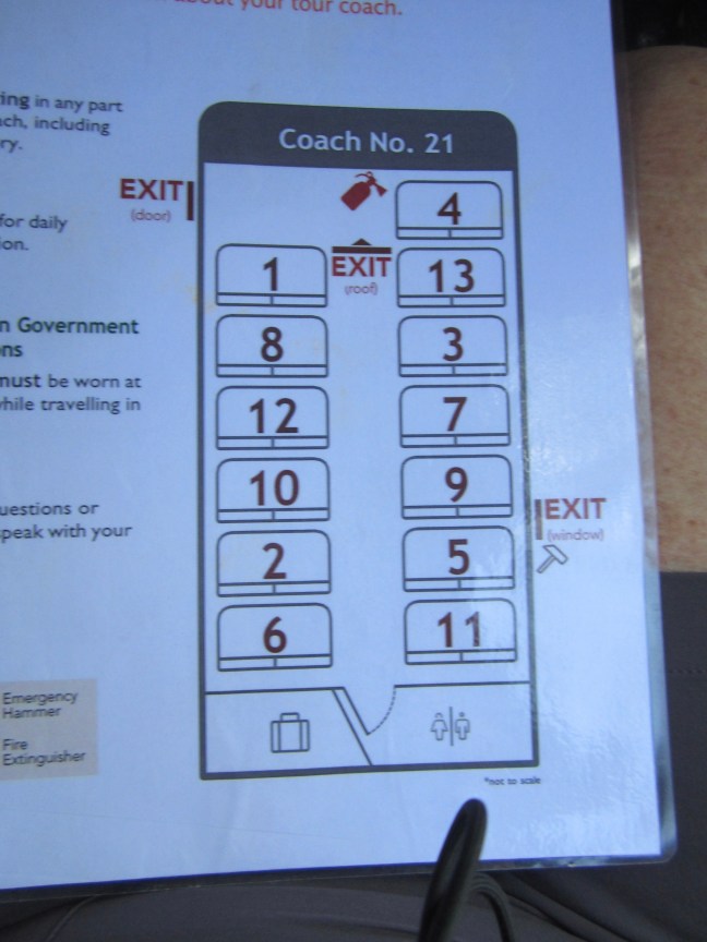
So we’d get on the bus. The first day, pick any seat. Then it turned out all the seats were numbered in a seemingly random fashion. Each seat had a diagram attached. If you are in seat 7 today, you move to #8 tomorrow and so on. (We did have a couple of spare rows, so if you got one of the back seats on a rough-road day, you could move forward, but remember your proper seat number for tomorrow’s rotation!)
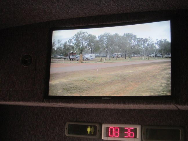
there was quite a gap and walls between the front row and driver’s seat, but you could still be a backseat driver! We had a front view video mounted high at the front of the cabin. Just a bit hard to take photos from if we were travelling though..
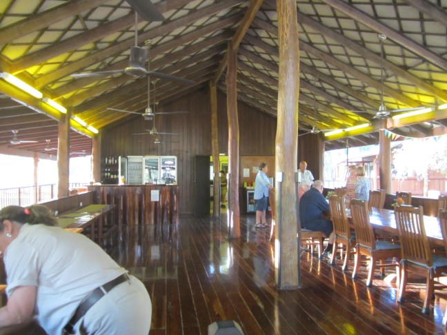
Outback spirit lodges had a similar set up for the communal area. At Lotusbird, the cabins were more upmarket than at Moreton.
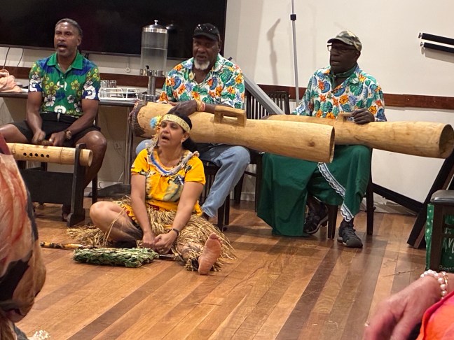
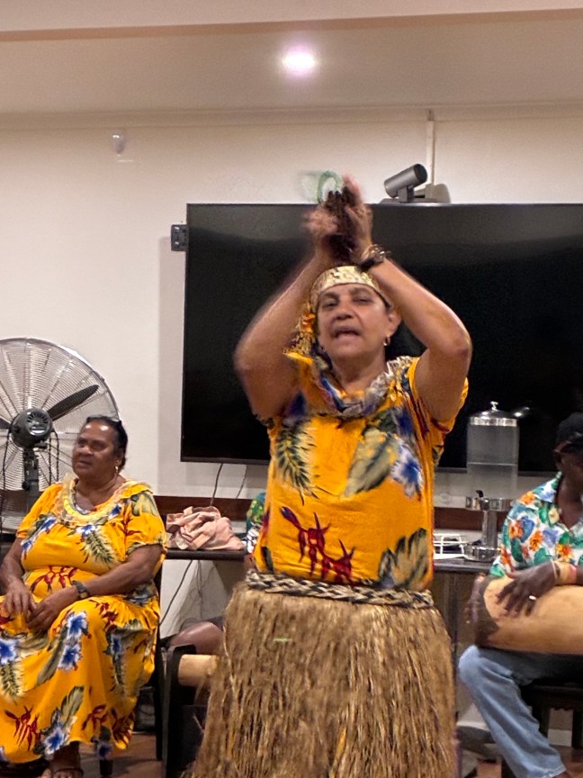
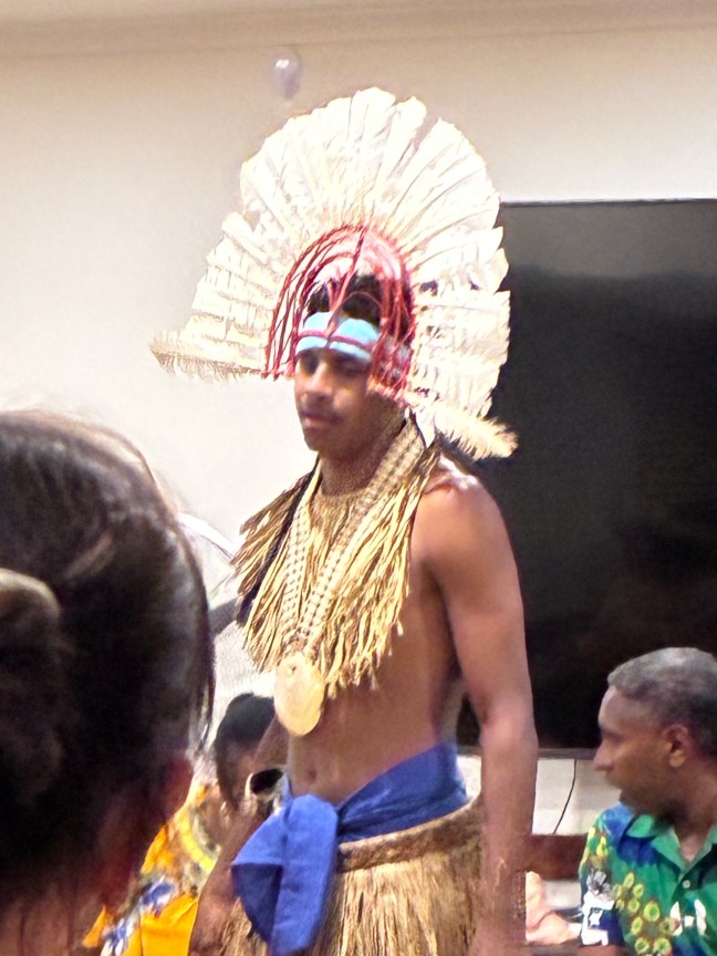
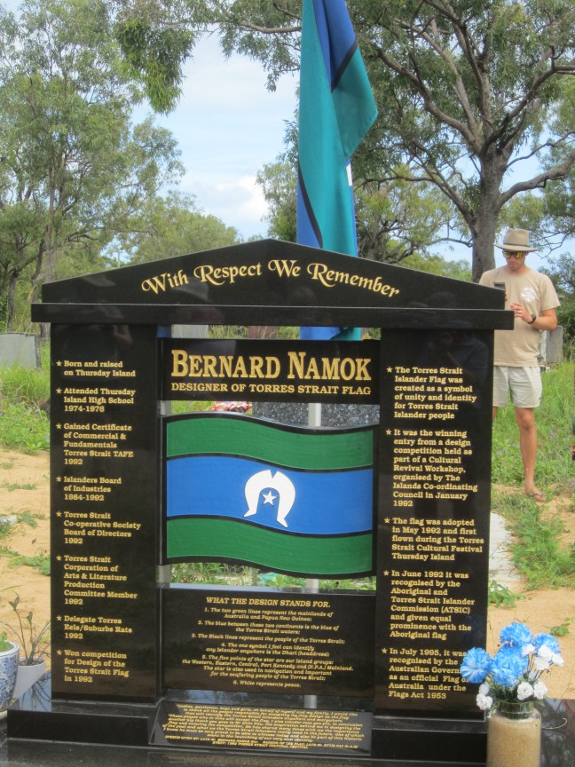
At Bamaga, we had evening entertainment. A group of islanders who tell some of their stories in dance. (And one who gave a bit of an introductory history lesson as well.) their musical instruments were interesting – the long thinner one on the left was made of bamboo and hit with sticks making a sharp sound. The other two were drums, hollowed out trees with a leather-type covering over the narrow end which was hit by hand. They sang accompaniament. The headdress on the young man is the inspiration for the central part of the Torres Strait flag. Two men dressed similarly, would turn their heads quickly and sharply in time, with the headdresses moving quickly. Very impressive. I hope they’ve got good chiropractors!
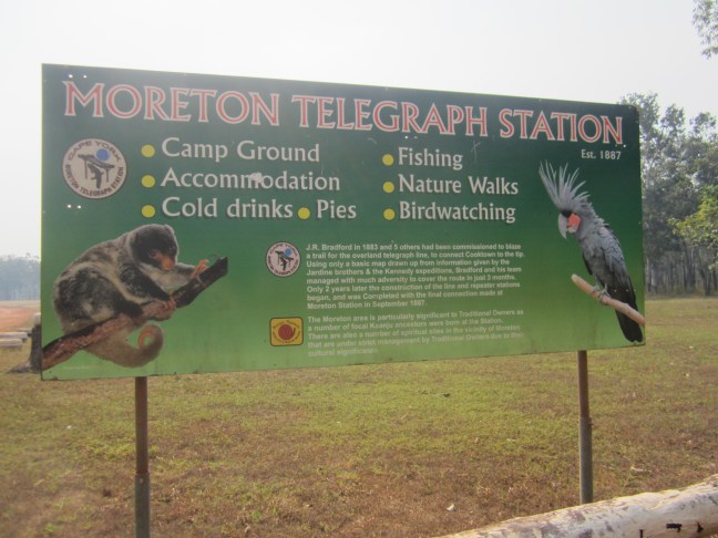
And a blurb about the telegraph line, if you can read it.
So now I’ve got to come back to normal life. For the last 2 weeks, we arrive. The word is that Debbie will check us all in and collect the keys to hand out. By the time you are in your rooms, your bag will be there. Meet at X at 5:30 for 6:00 dinner. ( or sometimes 30 min later.)
so yesterday I arrived at my new digs. A bit early and room not yet ready, so I checked in and then went to find some lunch and write up some diary. Eventually back to reception. Collected the key. But when I got to the room, my bag wasn’t here! and just now I looked at my watch. How long have I got before I’ve got to be at dinner? It’s a bit tricky to become deinstitutionalised!
Today it is seriously raining and a bit cool. Had planned to sit by the more remote (of 3) pool and swim and read. Hmm. Tomorrow (Wednesday) I’ve got a reef trip. You might get a report on that if I don’t drown and I’ve got any energy left.
The airport is located across the water on Horn Island so again we headed for the jetty and the water taxi. A couple of hours for a WW2 tour before heading for the departure lounge.
The airstrip was built for war duties and lined with defensive protection. Horn Island was bombed 500 times (in Australia, second only to Darwin.). But I’m jumping ahead.
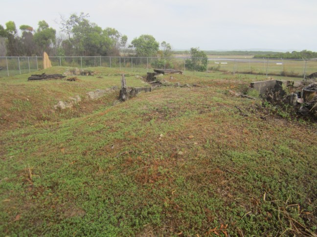
we were met at the wharf by a guy who runs tours. He and his wife (who wasn’t here today) seem to live and breathe the 1940s history. But first there was the museum. A whole lot of information. Not all about the wartime? But I’m not sure. We didn’t have enough time to take it all in before we were whisked off to the next stop. There, we were almost at the edge of the runway. Slit trenches built for the anti-aircraft guns. The artillery here not as potent as a bit later at Kings Point. It was explained that the trenches were laid out in a Z pattern, so if a bomb dropped, the sideways effect of the blast would be deflected at the corners and those in the trenches would be kept safer. At each place we stopped there was good signage explaining what was going on.
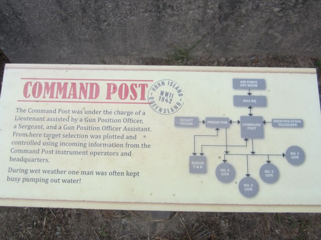
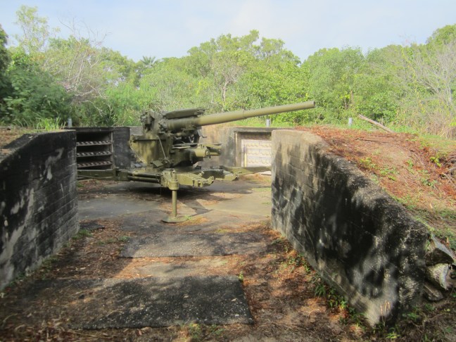
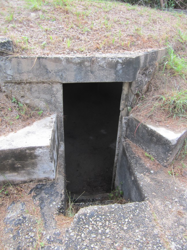
From here, we continued on to Kings Point. (Not, as you might expect from the name, on the water. I guess it was a bit higher. Further away from the airstrip.) Here was a more serious installation with underground bunkers for storing ammunition. We were shown a video explaining how the guns were set up to hit flying aircraft. They had a machine thing called a Predictor. (A bit like we would use a computer!). Input the height and est speed of the enemy aircraft, adjust for wind speed and direction, and calculate the direction and elevation needed on the gun to hit the aircraft when it had moved forward by the time the shell got that far. This information was transmitted by cable to the 4 guns.
Apparently the floor level within this compound has been raised over the years. So the gun would have Sat rather lower behind the sandbagged walls.
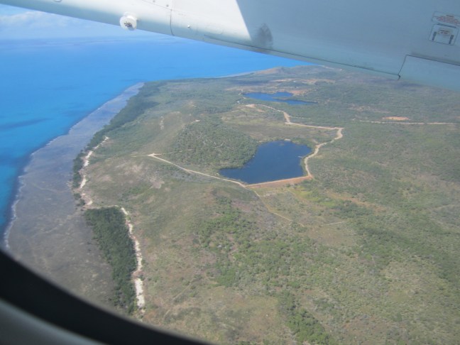
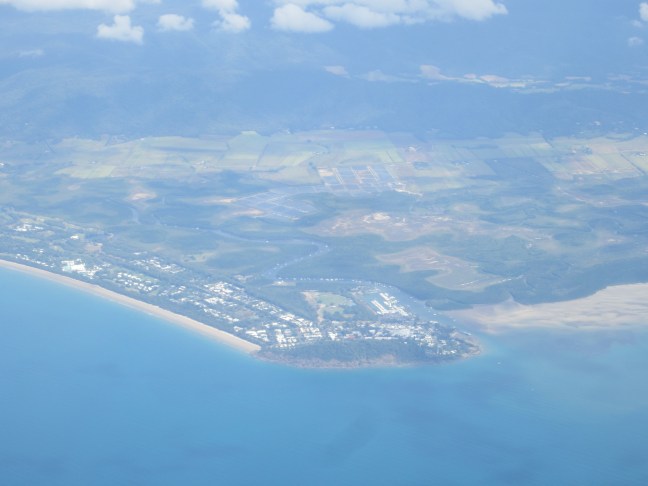
And then it was time to head south. A Dash-8 400 aircraft. Very long and narrow. About 1:20 to Cairns.
first, the last view of Horn Is. Not sure if this is the reservoir that they built to secure the island water supply. Then, the first sign of ‘civilisation’. Back to traffic lights and noise.
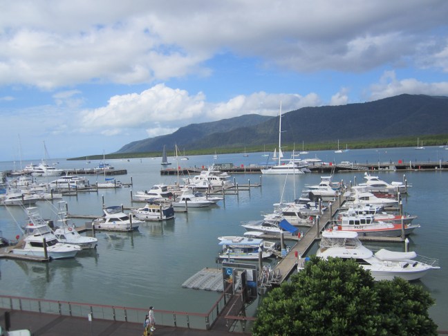
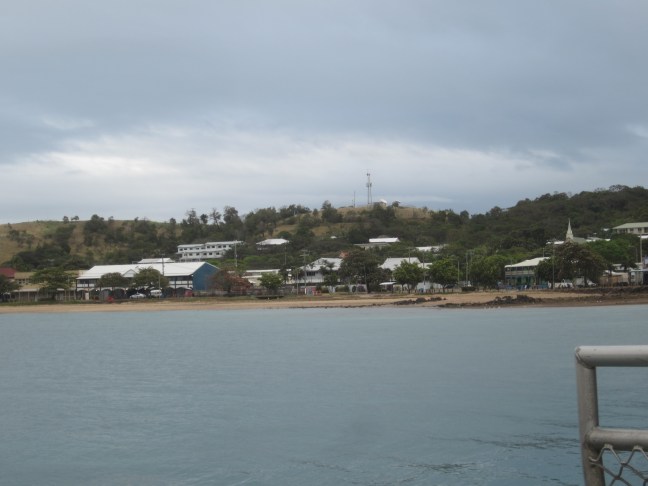
So our last night. At the Shanghai La hotel on the waterfront. View from the balcony of my room.
Farewell dinner. Various ways of dispersing the group tomorrow – our usual bus is in for emergency repairs. Our crew starts a new tour at lunchtime, with makeshift arrangements for the first few hours until the usual big white Outback Spirit bus is back on the road – expected to catch up with the new group in Port Douglas on Monday night and the crew does it all again. (They get 3 days off at the end of that trip. R&R in Cairns, interspersed with cleaning and restocking in preparation for the next trip!)
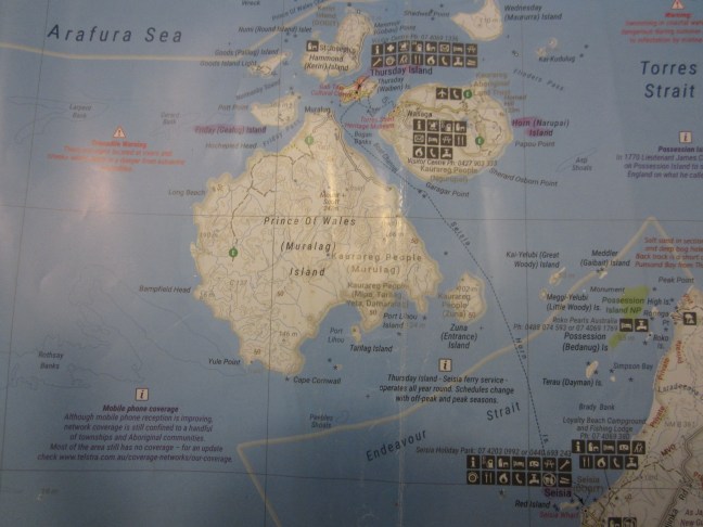
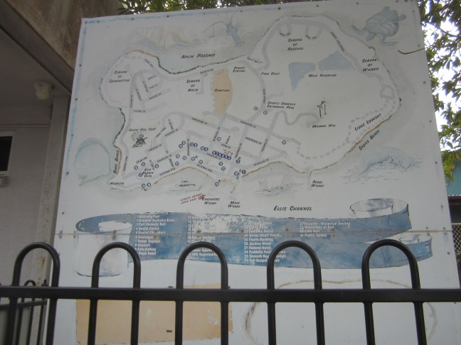
The map is a bit creased but hopefully you get the idea. The Torres Strait islands extend all the way from Cape York to New Guinea. Some are very close to NG. The Torres Strait flag recognises 5 groups of islands. The group around TI are the closest to Queensland. They are all part of Australia.
You can see that TI is quite small and in the middle of this group. Wednesday Island is in the North East. Friday Island is the smallish one WSW of Thursday. The large one (which doesn’t seem to have much development except quite close to the coast) is Prince of Wales Island (pop c.60). The next largest and SE of TI is Horn Island where the airport is. Then there are Hammond (pop260) and Goods island as the main ones nearby.
The population of TI is a bit under 3000. It has the regional hospital and high school and most of the main services for the islands. Horn Island, on the other hand has a bit more than 500. Friday Island is listed as 20.Wednesday Island approx 250.
The ferry from Seisia, near Bamaga, to Thursday Island, runs twice daily. It takes around 90 minutes.we took the morning ferry (8am?) on Saturday, with just a small pack with a change of clothes and toiletries etc. Our main luggage went back to Cairns on the bus. (One and a half days on as direct a route as possible, rather than the scenic routes we had taken on the way up.)
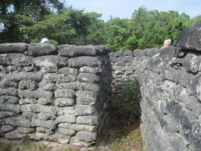
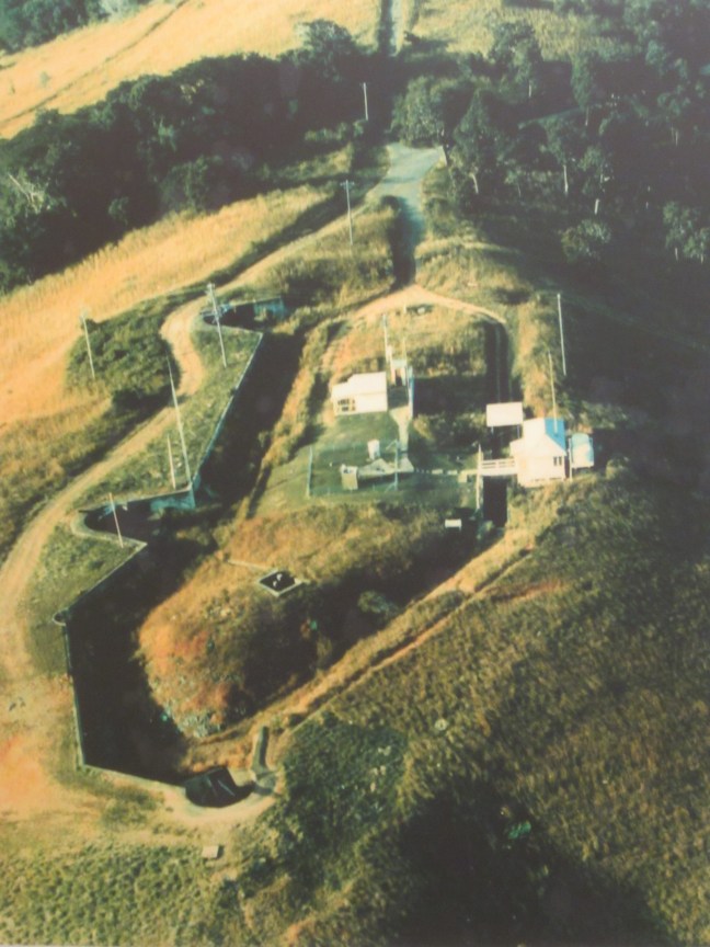
on arrival our small packs were taken straight to our motel, while we joined an island bus tour. First stop was Green Hill (the western high point ). Victoria Fort was built there in 1891-93 to guard against a possible Russian incursion. Underground tunnels were excavated to store ammunition etc, and a walled ‘keep’ encircled the fort at the top of the hill. Somewhere there were barracks, but they were long dismantled and the materials taken to Darwin.
it was abandoned as a military base in 1926, used as a signal station during WW2, and then by the Bureau of Meteorology as a weather station 1954-1993. It is now a museum. The above aerial photo was on display in the museum there.
apparently only one shot was ever fired in ‘anger’ when an approaching vessel did not announce its intentions. Apparently it was a friendly ship.
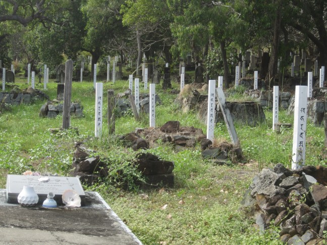
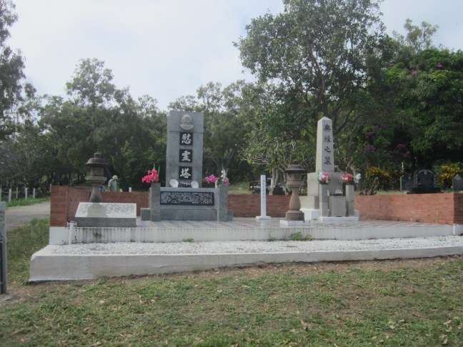
We then did a circuit of some of the sights. Stopped at the cemetery where there are many Japanese graves, mainly relating to the pearling industry. Often they are only identified with a white post. Interestingly, in the area I walked by, there were very many graves for the same family in close proximity. I assume family blocks have been reserved. Bernard Namok is buried here. He designed the Torres Strait flag: horizontal stripes of green on top and bottom (New Guinea land at the top, Cape York land at the bottom) and blue (ocean) across the middle; a 5-pointed star in the middle, surrounded by a semicircular representation of the headdress commonly used in traditional dances .
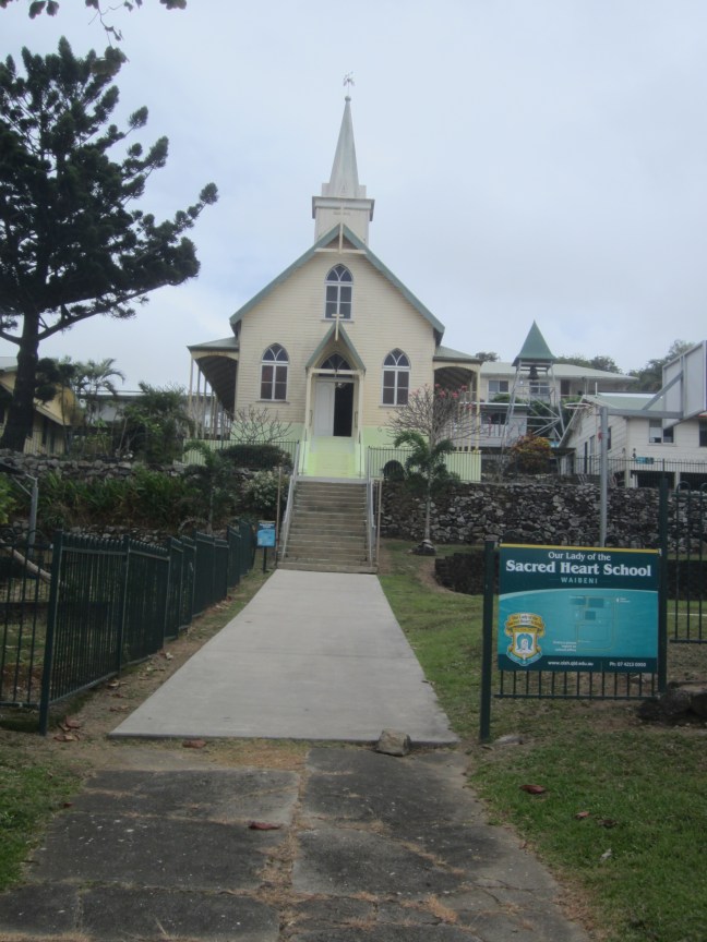
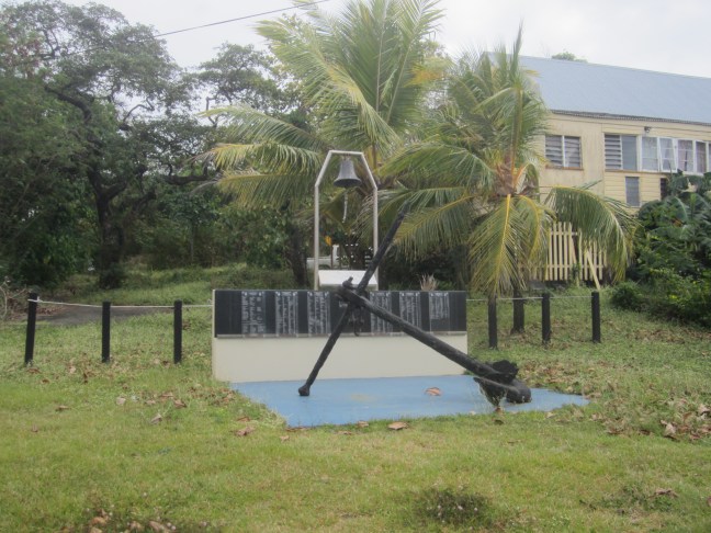
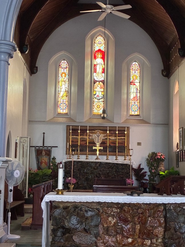
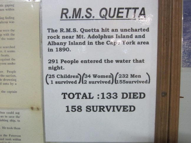
Back in town the Catholic Church is the oldest in the islands. The Anglican Church ( which for many years had cathedral status, but there is no longer a bishop based here) was built as a memorial to the sinking of the Quetta, a ship out of Brisbane heading for TI in February 1890, which hit an unchartered rock just past Albany Island (around 30 km from TI) with huge loss of life. The ships bell and anchor are in the grounds.
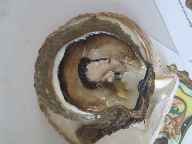
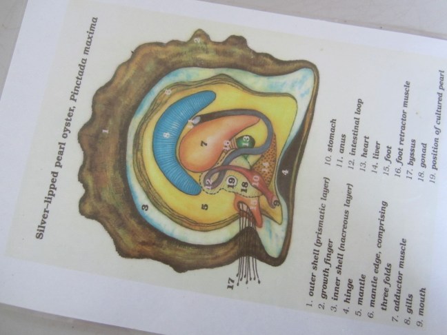
After lunch we visited the Kazu pearl farm on Friday Island. The big pearl companies pulled out many years ago. The owner of Kazu previously worked for a big company and bought the business and it is now family-operated. He is Japanese. I must admit I didn’t understand all the details of his operation. It seems they now only do tours for Outback Spirit (that’s every 2 days in the tourist season) and do some sales through other avenues. Interesting to watch him with dentist-like instruments, implanting the small ‘kernel’ around which the pearl will grow – though the barely-opened shell. The shells are quite large – perhaps 4 inches in diameter (what is that in ‘real money’). 6 shells are placed in a hanging basket 2×3 and suspended on racks in the sea off their jetty. It takes 2-3 years to grow good-sized pearls, and the shells have to be washed several times a year. I think he said he has 5000 active shells at any time. Keeps him busy!
#19 in the diagram indicates where the pearl kernel is placed. To illustrate, a pearl – round, white -located in the same place in the live shell. (When he opened this shell. We could see the heart of the shell beating.
Friday Island is the one with the two humps. Taken from green Hill.
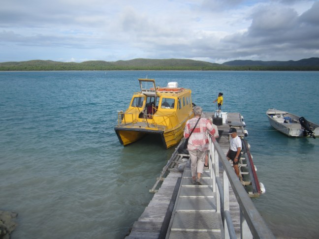
We caught the yellow school water taxi to Friday Island. Most of the islands don’t have schools, and TI has the only high school.
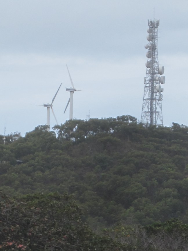
Millman Hill is the eastern high point. It has the Telstra tower which has recently been upgraded to 5G, anfpd the two new wind turbines – but they are still waiting for parts from Denmark.
Given it is a regional centre, I was expecting the shopping strip to be a bit more vibrant, but most shops close at midday on Saturdays and it seems many businesses don’t open Saturdays, so we probably didn’t see the business area at its best.
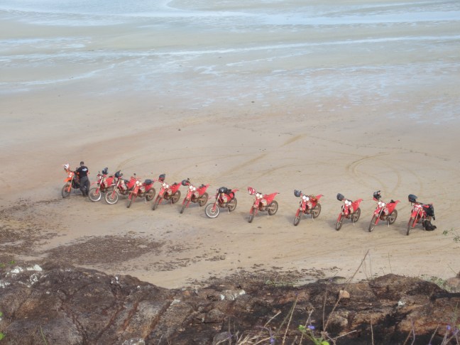
An earlier start tan usual to beat the crowds. About. 1 hour drive from Bamaga with the last 15 km or so very rough and narrow. The jungle is encroaching on the road and we had to brush past branches and the vines rattled on the roof. Will the solar panels on top survive? The parking area is near the beach. The tide was going out and occupied by trail. Ike’s by the time we got back. Did I mention a couple of days ago that trail bike tourism is a definite thing up here? The operators have a trailer for the bikes and a bus thing for the riders in between highlights.
and the bikers in full gear and tall boots headed up as we came down!
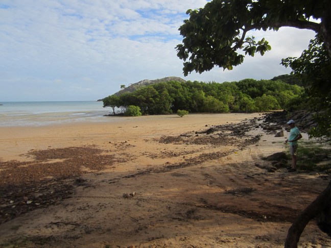
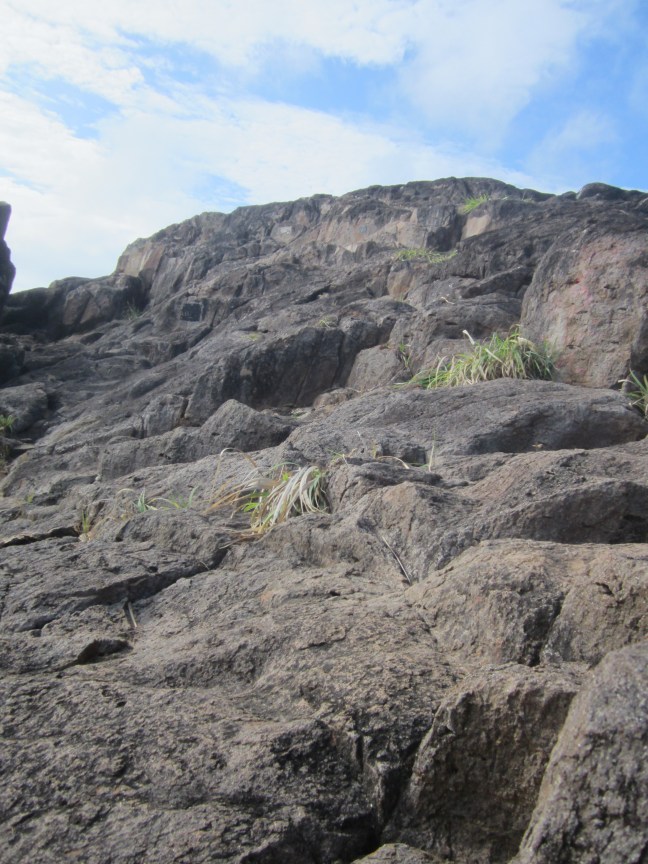
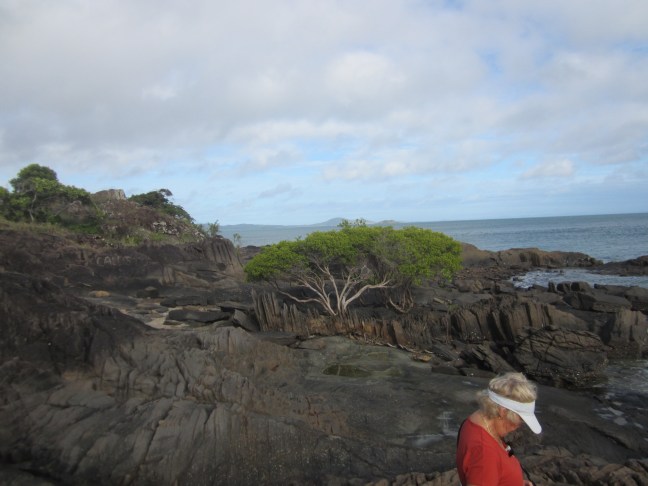
So we headed off. Probably a bit less than 1 km walk but took about 25 minutes. Not a difficult walk but sort of rocky-rough rock platforms. Up a bit then down.
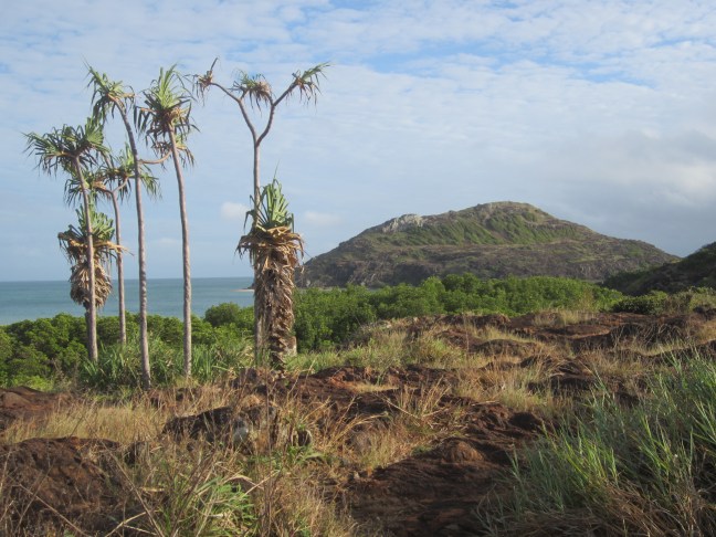
When we started out, this is what we could see. We imagined that the Tip must be over that hill ahead.
But no. That is York Island which is the westerly of the two islands off the Tip.
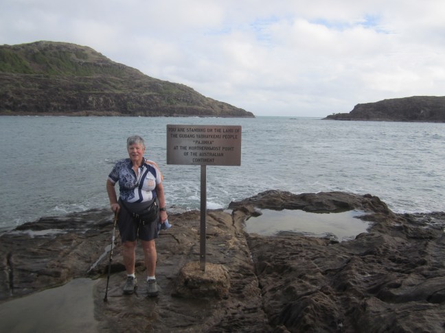
I had envisaged we would arrive at a cliff top as our destination. But the end is actually down by the water. The previous sign has recently been replaced. (It had bullet holes ) So I got there (indeed we all get there despite one sprained ankle on the way in, and one with ankle surgery not long ago – she saved herself for this day and had some help from the staff. You don’t often see me in a blog photo. Usually it’s my bicycle leaning against something to prove I got there.
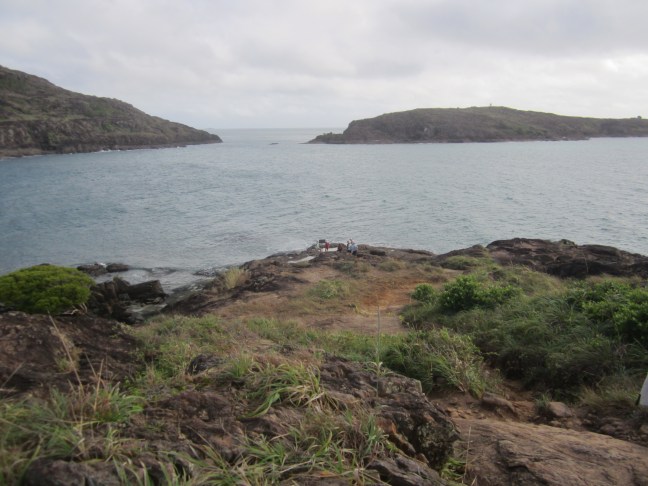
That’s York Island on the left and Eborac Island on the right with a navigation beacon on the top.
So then we went looking for history. Retraced our route about 12 km – with increasingly difficulty as we met oncoming vehicles on the narrow track – and then headed roughly east. The top of Cape York is roughly an E-W line with points at the eastern and western extremity, but in the middle is a point heading north: the Tip. So heading east took us to Fly Point with Albany Island paralleling the coast for several km to the north. Strong currents flow through Albany Passage and this stretch of coast had a lot of shipwrecks in the latter part of the 19th century. As activity in the north increased with the discovery of gold in the Palmer River area, the government decided that they needed official presence on the Cape.
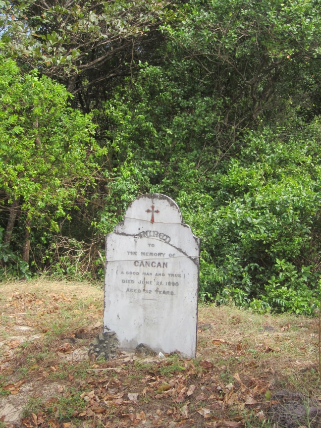
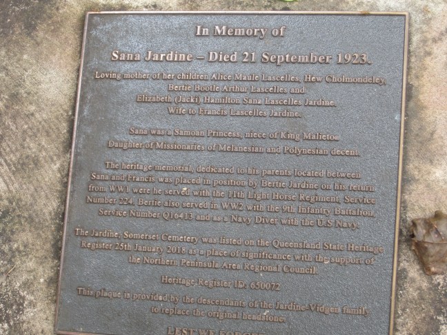
John Jardine was appointed the first police magistrate and Commissioner of Crown Lands and took up residence in 1864 in this area. On the flat at Somerset Bay, facing across to Albany Island, and extending up the hill to the SE. At one stage there was quite a settlement here with a small military detachment. John J was only here a couple of years. (He was aged 57 when he arrived. ) his sons Frank and Alexander drove a herd of cattle up from Rockhampton and started a cattle property. Frank stayed on, and eventually got into pearling. Down near the bay there are a number of graves including a couple of Japanese pearl divers. Frank married a Samoan princess and both Frank and Santa are buried here (Frank died of Leprosy in 1919). Earlier, in 1848, Edmund Kennedy’s attempt to reach the tip failed. Kennedy and his aboriginal guide Jackey Jackey made a push to the end, but Kennedy died and only Jackey Jackey arrived in this area to meet the rendezvous ship. Plaques and graves all over the place.
a few questions from previous comments:
Plan B for the Jardine R crossing: one previous trip they got a helicopter to ferry the group across. Presumably organised separate bus transport for the final days on the mainland.
the ingenuity of bus drivers: our driver an bus got back to Cairns with some further delay: more fuel leakage was plugged with the final barrier, two foot thongs tightly tied onto the fuel drum blocking the hole! It went in for repairs at the dealer in Cairns on Sunday afternoon. The new group is being taken to Port Douglas on a replacement coach, with the regular coach and driver expected to take over on Monday night.
And birds? Lots at Lotusbird Lodge. A great dawn chorus. Lots of water birds: egrets, jabiru, magpie geese. At Moreton Telegraph Station late afternoon there was a non-common appearance of a palm parrot (at least I think that’s what they said). Great colouring and very raucous and distinctive call. But too far away to get a photo and didn’t appear the next afternoon.
Our usual 8am getaway, heading north from Moreton Telegraph Station. Initially following the Telegraph Track but beyond Bramwell Jnct, that becomes a serious 4WD track so we turned slightly NE on Bamaga Road which follows the Divide. (no slowing down for creek crossings for most of the rest of the day, but still some very corrugated sections. We didn’t seem to have climbed much but at times it seemed if you stood on tip toes you might be able to see both the Gulf and the East Coast. Especially in a couple of places where the vegetation had changed to heath-height.
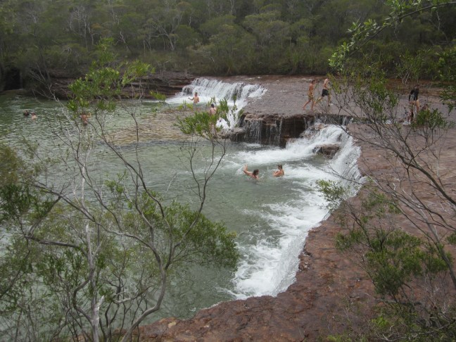
The excitement of the morning was at morning tea time when a diesel smell was noticed – and we were dripping fuel. We had arrived at the car park for the Fruit Bat Falls and a designated swim. So after cake and drinks, we got changed in the facilities provided and left the ‘mechanics’ to sort it out.
A nice pool but enough water coming over the low falls to make it difficult to actually reach the wall behind the falling water. Photo below. Entry to the main pool is down to the left across a rock platform. A pleasant interlude, especially as there has been little swimming to now because of croc danger. When we got back to the bus, the driver had remembered a grandfather’s tale (as opposed to an old wives tale) that you could use soap to seal a hole in the petrol tank. 100km later, it seems to be working ok. Hope he gets back to Cairns on Sunday with our bags. (We fly back with hand luggage only.)
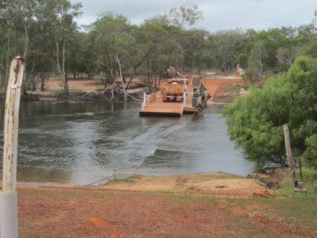
Next obstacle was the Jardine River which is crossed on a small vehicle ferry. It has been intermittently out of action over the last month but a bit south of there we were passed by the Outback Spirit bus ahead of us, having left his group to cross to Thursday Island this morning. Same itinerary, 2 days ahead of us. (There is another bus 2 days behind.) so if he got this far, the ferry must be working. And there it is.
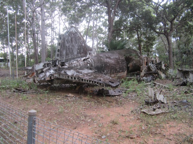
So we’re almost to Bamaga. Only one more stop at the crash site of a DC3 approaching the old aerodrome just south of there in May 1945.
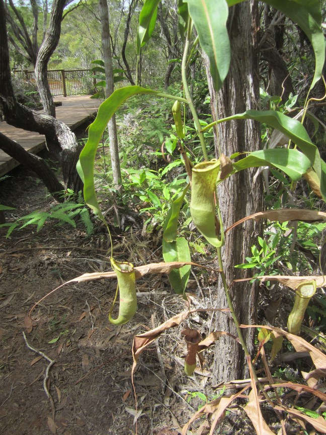
and to round off the daily report, two vegetation shots. The first of the unusual heath lands mentioned above, taken from the bus so not the best quality. The second of a Pitcher Flower plant – they are carnivorous, presumably insects go into the deep flower looking for nectar and get caught in something sweet and sticky! This one near the Fruit Bat Falls.Also, if I can make it work, a tall termite mound at Bramwell Junction.
Tomorrow an early start. Hopefully get to the Tip.
Often at this end of a blog the blog troll decides I’ve done enough and won’t let me go back to fix typos. I expect by now you can figure out what I meant to say!
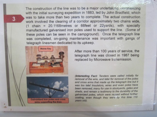
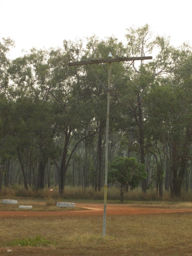
We have come about 130km east of Weipa so now back in the middle of the peninsula. We’ve had two nights here. A chance to unpack and rearrange. We are on the line of the Queensland overland telegraph line. (20 years or so behind the planning for the one from Adelaide to Darwin.) The route was surveyed in 1883. A corridor approx 2 chains wide had to be cleared and galvanised iron poles erected to carry the single wire. (Renovations were made during WW2 to make it a 4-line line.) Work started at both ends – one construction party moving south from the tip,and the other moving north (I think from about Laura which was already established as a centre with the nearby goldfields.)
The south moving party got to the Wenlock River and built Moreton Station in 1887. The north-moving party only got to Mein, 90 km away before having to call a halt. So all was ready except for the gap. So for a few years, messages were transmitted with the assistance of telegrams carried on horseback between the two. The line was a key aspect in wartime communications. In the 50s, I think it was, that the use of Morse code to transmit messages was replaced by telephone, but the line continued to be used and supported the peninsula inhabitants – and the beef industry here – until 1987. The telegraph station building has long since been demolished. The museum has a photo.
I understand all the stations had a similar design. The only one still standing is Musgrave which I think was in a blog a couple of days ago. They were well fortified against possible attack from the local aborigines.
Telstra has taken over communications!
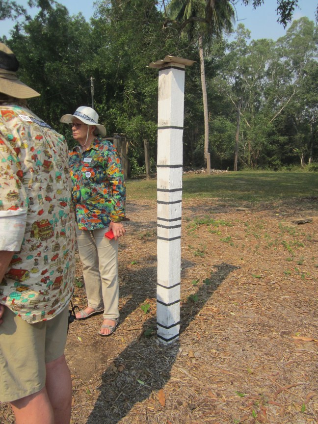
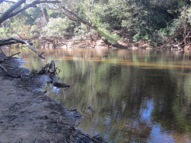
We are located on a large flat area with a caravan park, permanent tents for rent to travellers, and the property owner’s house with shop etc, in addition to the Outback Spirit central building and several blocks of accommodation rooms. This morning we went for a walk down to the Wenlock River. It’s quite a distance down to the river. Apparently around 12m lower. Our buildings are all raised – 4 steps up. And each wet season, they usually get flood water up around the buildings. Near the caravan park is this pole with flood levels marked. ( but heights not noted) the highest measured flood was 1907, then coming down the pole 1953, 1939, 1935.
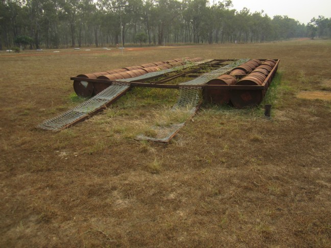
There is a new bridge over the river. (2023). Some time before that there was only a ford. And in the olden days, if you wanted to get your car over the river when there was too much water, the locals had a solution. A car ferry made of 44 gal drums, and using manpower to pull it all across with ropes. One of these ferries is still out the from in considerable disrepair. And then the little museum had some photos.
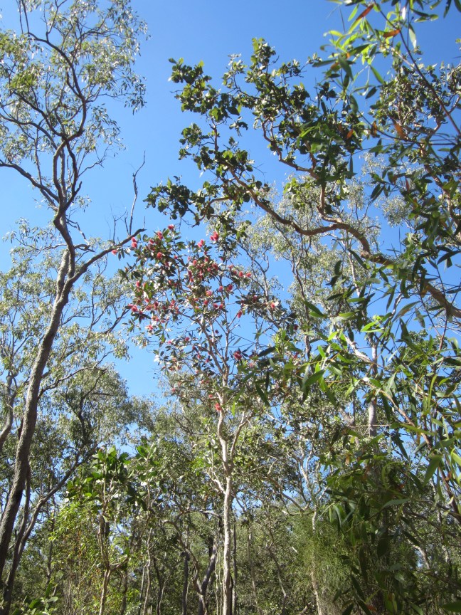
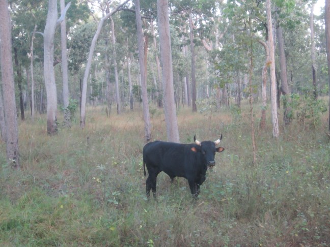
It’s a pretty river though with the ever-present concern about crocs. And some interesting trees. I’ll leave you with some random photos, including the fellow out my back window this morning.
sorry. I had trouble putting some photos where I wanted them in the previous blog, and then ran out of time. Drinks and dinner called. So back to where I was. some photos I had intended to put in before the ship loading. Assuming I can make it work now.
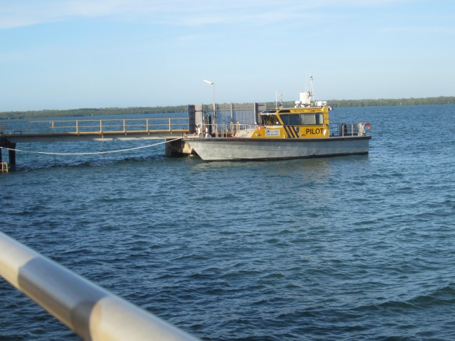
the pilot launch.
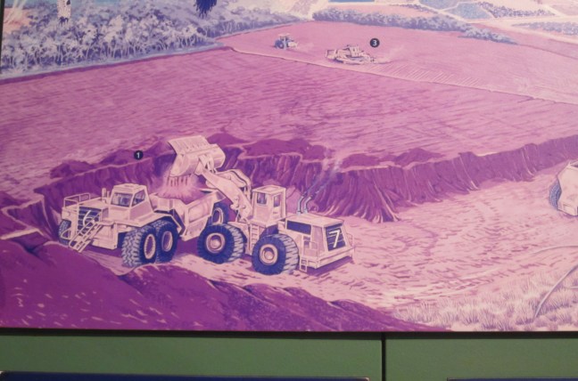
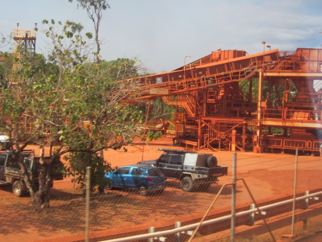
Mining: a diagram from the cultural centre depicting how it worked; as it looks when the mining has finished; then it gets rehabilitated – we had lunch by Lake Patricia, an area that was rehabilitated some years ago.
and the last one: how the other people travel on this trip: everyone is either ‘going up’ or ‘coming down’.
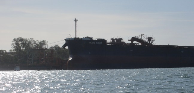
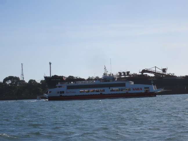
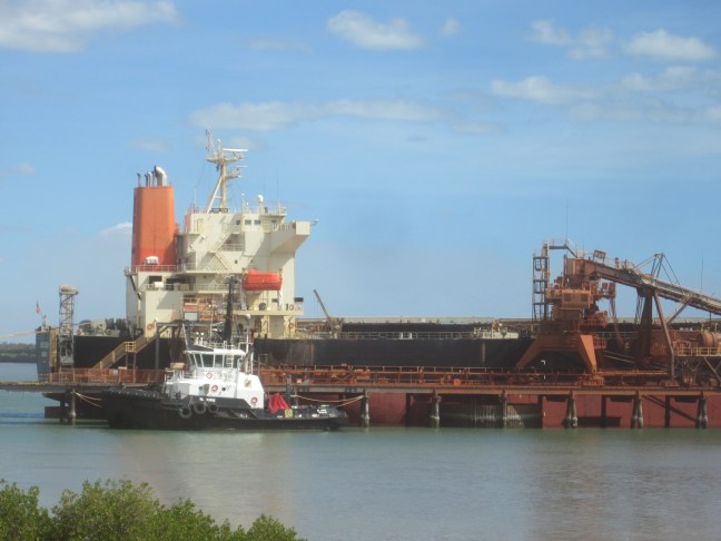
But first thing this morning we had a river cruise. A small tinny thing like for the crocodile cruise. That seated probably 18 or 20. On the Embley River which is south of the town. First we went to have a look at the ships that had come in overnight. This is one of them can’t find a sensible photo with both end to end with two conveyors ready for action.
Then the Rio Tinto barge/ferry thing came along. One of the mines is across the river with no bridge access, so all equipment, vehicles and workers go across on this boat.
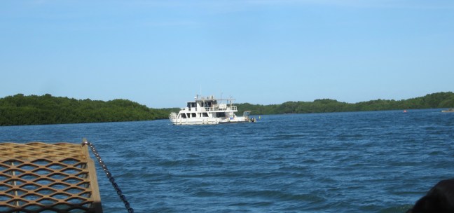
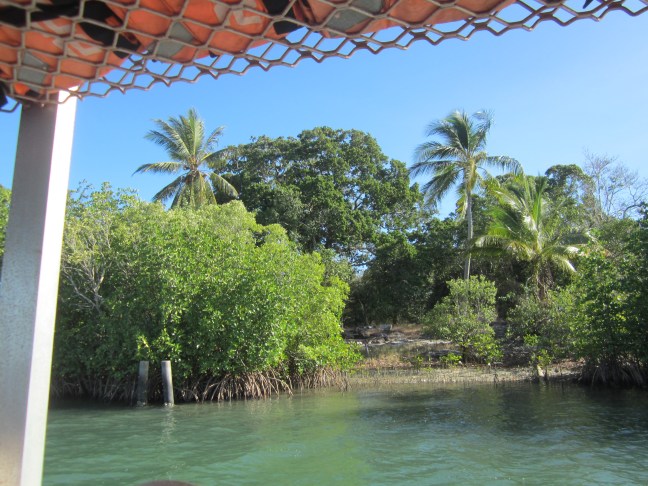
After that we retreated a bit, crossed the river and headed up a wide creek that provides shelter for boats that want to stay a while. The first one has permanent residents who live here and work in town. The opposite shore was mainly mangroves but occasional palms and one or two small beaches. But beware of crocs!
We did a couple of turns around the town. The older housing was built on reclaimed mining land. Full town facilities for the 4000 (?) residents. And after lunch at Lake Patricia we headed out of town and east , back on the VERY corrugated road we’d come in on yesterday before turning north to Moreton Telegraph Station.
Outback Spirit (which I’ve only just learnt has been bought out in the last year or so by Journey Beyond) has a separate operation her, adjacent to a couple of campground operations. We seem to be tucked at the end of everyone else so probably won’t be much disturbed by them, but not as secluded as we were at Firebird Lodge. We’ve got 2 nights here so a bit more relaxed. And some more washing done!
The last few days have been blue skies and sunny but not too hot.
We think of Weipa being on the Gulf of Carpentaria, but its adjacent waterways are actually river estuaries and Albatross Bay – which then opens onto the gulf proper.
Many of you will recall that Dutch Captain Jansz visited this area in 1606. (Grade 5 or so history). He apparently reported red cliffs hearabouts. Then Flinders in 1801 also noted red cliffs. Finally in 1953/4 a geologist came to visit ( by that time there was a Presbyterian mission and cattle properties) and he reported bauxite. It took a few years but in the late 1950s, Comalco had set up, initially sending the ore to Bell Bay in Tasmania for processing. Rio Tinto took over early this century and own the town and a considerable swathe of land roundabout. The story is that there is enough ore for another 60-70 years and huge tonnage is going out each year. Half to China, half to Gladstone for the next stage in processing it to alumina. Then there is further processing to aluminium. Some of that is still Bell Bay. Some to NZ. Not sure about the rest. There was some surprise when we arrived last night that there were no ships at the wharf. But two there this morning so the pilot launch must have been busy in the interim.
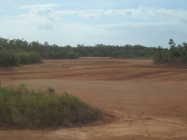
The bauxite is apparently found just a metre or so below land surface level, and the lode might be one to several metres deep. So where mining has occurred the topsoil has been piled up and the land laid bare. Later it is being rehabilitated. It is then trucked to near the wharves, stockpiled, loaded onto the conveyor system which takes it under the road and the overhead to be dropped into the waiting ship. Careful so the ship isn’t overloaded. Do t want the ship going aground at low tide.