A Long Day in the ‘Saddle’

We left the comfort of the Outback Spirit camp at Lotusbird Lodge early, heading NW to Weipa. And my first view of the Gulf of Carpentaria. I felt a bit like Burke and Wills. Would we get there?

First there was Musgrave Road House – an old telegraph station but now fuel and food for travellers on the Peninsula Development Road. We spent most of the day on the PDR. Initially promising with a bitumen surface, but we soon found we were to get alternating good bitumen with then good/bad/very corrugated dirt surface.

We were only about halfway to Coen which was to be our morning tea stop when we came to a gentle stop. “Just a bit of a problem” our driver announced. We have air brakes. Seems the connection between the air hose and brake cable had separated. He thought he had reattached it quite quickly but after about 100m it was clear all was not good. So we all piled out to stretch the legs while he consulted with the head mechanic in Albury (Outback Spirit HQ). Needs a new connecting screw-on thing. Several such things in the Spares box, but only one that fits the current task. Driver on his back in the dirt under the bus with one of the passengers ready to offer assistance if required, but all was fixed and we were on our way with only about 40 min delay. (It was only last night over dinner that there was a discussion – we are so far from anywhere – what would we do if our driver got ill or there was a mechanical issue. Our driver was confident it could all be sorted out fairly quickly and gave some examples. And now we have another example!)

So with a shortened morning tea at Coen and lunch at Archer River Road House, we were almost on time at Weipa. It was a big drive. Even with comfy seats I was getting a bit squirmy. Not much of interest as the ongoing treed cattle country passed by. (Though there was one cattle property which has imported grass which just now is very green, most unlike the natural grassland. And they even had big hay rolls, looking like a Victorian farm. ) I listened to my music as I would on a road trip but couldn’t sing along!

So what DID we see? Musgrave Telegraph Station building – looks like an old house; New 12m high bridge to avoid the ford over the Archer River; and the nice looking Archer River – quiescent in the dry season. And I’ll also attach a ‘from the moving bus’ pic of the typical country though this one does show the last view of the eastern ranges.

we’re due to see more of Weipa before we leave tomorrow so I’ll leave writing on Weipa until the next blog.

Maps

My big Hema Cape York map is a marvel. It has insets for the parts where more detail is needed. The Port Douglas to Cooktown section is @ 1:250,000. Then we did Cooktown to Laura and Lotusbird Lodge/Musgrave is @ 1:700,000. And now we are onto the less detailed section to Weipa and across to Moreton telegraph Station tomorrow using the full map @ 1:1,100,000. On Thursday as we move north of Moreton TS towards the Tip, we’re back on 1:250,000.

On the map shown here, I have marked 3 locations with yellow numbered squares: (1) is Cooktown. (2) Is Lotusbird Lodge – south of Princess Charlotte Bay. (3) is Weipa. Impressive how far we have travelled in 3 days with just 2 days of driving. Moreton Telegraph Station is in the pink shading east of Weipa.

R & R Day near Princess Charlotte Bay

Princess C Bay is in that bump on the eastern side of Cape York. Lotus Bird Lodge where we have had 2 days is just 60 km from there. Today, in groups of 3, we flew by helicopter to the mouth of the North Kennedy River over dwindling watercourses (as the dry season sets in) and billabongs. From the air (we were 500 something up – either feet or metres, but it seemed pretty close) we say freshwater crocs basking on sand bars, salties swimming and basking, groups of wild pigs ( they do a lot of damage digging up roots in forest and near watercourses), and groups of cattle on the cattle run adjacent to the national park. An interest in hour with a very knowledgeable pilot who lives here for the season.

Outback Spirit has 5 crews each doing 10 trips, so their lodges are occupied pretty much continuously as busses come through May to October. So the pilot does this every 2 days. 6 trips today.

Back at camp I finally had time to catch up with the diary and blog and recording the photos that I’ve taken. (The roads are too rough to attempt to do any writing en route.)

Then this afternoon there was a walk around the camp lagoon. About 2km all up. Two types of water lilies, interesting trees, lots of birds including jacanas, great egrets and magpie geese, and a few cattle who we managed to shoo off the track. Oh yes, and a bower bird’s bower.

The water lilies:

The magpie gees roost high in the trees. Near and far.

Egret and the bower bird’s bower:

Off to Weipa tomorrow.

Heading West and North

We’ve left the coast, heading first from Cooktown to Laura on a route used by the miners to get across to the goldfields. Battlecamp Road. Early on many near-town properties. Interspersed by what the dairy farmer father of a school friend would have described as ‘scrub’. Not scenic. Then across the coastal ranges but not as steep as yesterday. It eventually turned to cattle country – a bit more open but still well-treed. Following the Normanby River. Crossed it once, and later in the day (further north) met it again but didn’t have to cross the scary-looking ford there.

There used to be a number of cattle properties through here. Many of the properties have been taken over by the Lakefield (Rinyirru) National Park. We visited Old Laura which has been refurbished a bit for the tourist trade. The upstairs was bedrooms. Downstairs was mainly open, with a detached kitchen out the back.

Here we have the well and tank stand, and some outbuildings.

Then on to a guided walk with a local aboriginal elder to some rock art south of Laura. Sidle along and up on a sandstone ridge to a large overhang. Quinkan country. Glad I had the walking stick – the track up was a bit rough with uneven rock ‘steps’ in places.

I can’t remember all the stories. The area is called Split Rock.

So then we headed north. Through the Lakefield NP. Mainly Savannah-type vegetation . Occasional fields of magnetic termite mounds – the narrow end points N-S so it misses the hottest sun in the day. Fascinating.

It was a long drive. Not much need for driver commentary. Bulldogs playing Adelaide so I listened to the footy using the bus wifi. Pity about the result. So eventually we arrived at the Lotus Bird Lodge – owned by Outback Spirit – a little oasis surrounded by a cattle property. We’ve got 2 nights here. Today (next day after the report above) we’ve had a helicopter trip and a local walk then tomorrow (Monday) we head north again so not sure when I’ll get time to write about today and the next.

To Cooktown

Cape Tribulation was the furtherest north I’d previously been in QLD. It was off the coast here that Captain Cook’s troubles started. Apparently it was one of his young midshipmen who knew about fothering (is that the right word?) a sail to plug the hole in the side of the ship. (Get a spare sail. Add all the possible dirty/sealing stuff you can find on board – fat, goat poo etc, line up the ship with the wind from behind, suspend the sail over the front (bow) hang on tight to either side of the sail, let the ship move forward until the sail is level with the hole, then pull tight! The pressure of the water will forced the sail into the hole and it becomes a plug, giving you half a chance of keeping going until you npcan find somewhere safe to beach the ship.

Meanwhile the little boats had been sent out to reconnoiter and had found the Endeavour River not all that far away. They limped in there, aimed for the shore at high tide possibly with some logs laid out as a roller-base, and managed to stay there when the tide went out. They were there for 48 days while the ship’s carpenter got out the ‘spares’ (timber etc) and repaired the ship.

Apparently this area was a neutral meeting place for the local indigenous clans and they didn’t get a lot of opposition. Some action of the crew caused concern but one of the senior Elders got with Cook at a place now called Reconciliation Rocks and calm was restored.

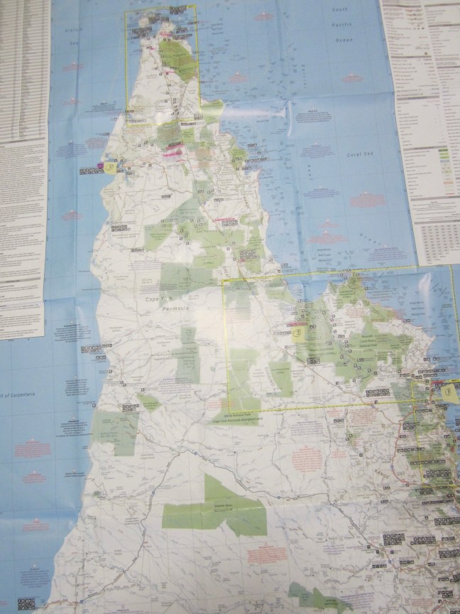
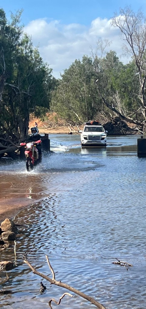
So we headed north to learn more about all this. The Bloomfield Track has a reputation. Certainly the creek/river crossings would put it out of action in the Wet, but the steep pinches I heard about were OK. The Track crosses the coastal range with several steep bits, but the main ones have been concreted – some with a sort of ribbing to give more grip.

The Lions Den Hotel for lunch. Made it onto the map I was using – it’s a Hema map of Cape York, with several insets. This day the scale was 1:250,000. All the detail we needed was there (provided the road wasn’t too bumpy and I had on the good glasses). A curiosity of the hotel is the tradition for writing on the walls. Started early on leave messages for people travelling that way, but now it’s just rubbish mainly. (I wonder if the writers take a photo of what they’ve written?) the toilets are in a separate building and have a sign “please do not write on these walls or doors or window frames. Go and do that on the hotel!

And so onto Cooktown. The settlement started as a port for the N QLD goldfields further west (Palmer River) in the 1870s. Flourished through the 1890s. Lots of Chinese miners – well organised groups.

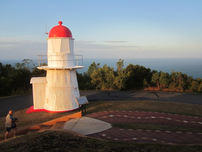
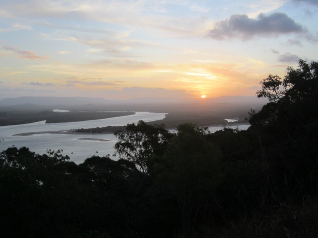
With all this activity they needed a lighthouse to make shipping safer. The lighthouse preceded IKEA. Prefabricated in England and assembled on the top of the hill here that Cook used as a lookout to plan his exit. Grassy Hill. But no longer grassy.

As I took the lighthouse photo there was a ship out there heading south but I can’t see it in the photo.

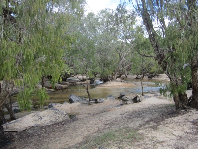
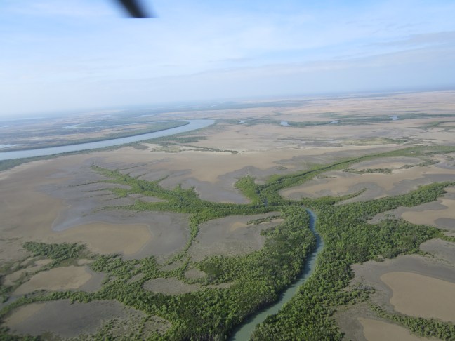
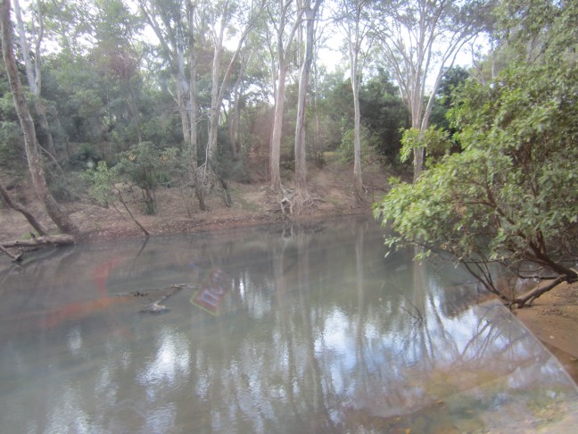
the next one was from a bit further down the hill looking up the Endeavour River.

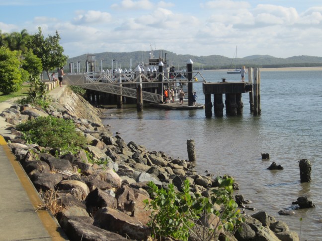
Cooktown is very proud of its heritage. Lots of signage in the Main Street (Charlotte St) with information and photos. Many more bigger buildings in 1890 than there are now. And down at the end of the old wharf area, is reference to the pilot station that was once here. (Sea pilots). I did a quick google search to see if I could find more but not so far successful. Ships no longer come in here.

but famously, the Britannia came in 1970 for the Cook bicentenary. They built a set of Concrete steps so the queen could alight from the lighter bringing her ashore. But it was low tide. The steps couldn’t be reached. They are still there in the middle of nowhere. Unused. But apparently the locals covered them in flowers when the queen died.

Ok now I’m having problems with photos. Thought I’d taken more but they seem to have disappeared. Never mind.

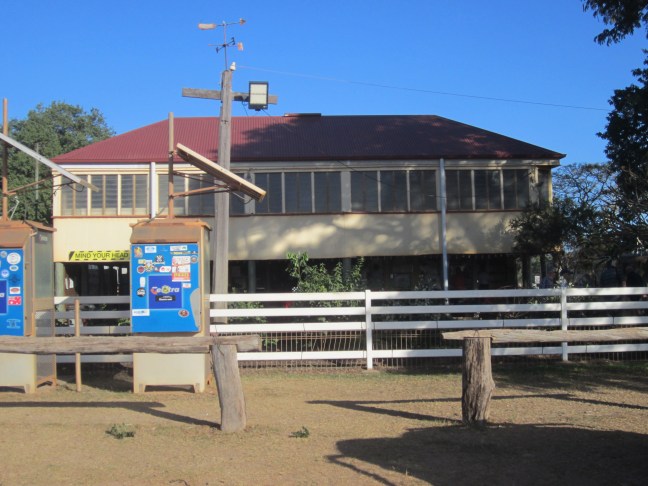
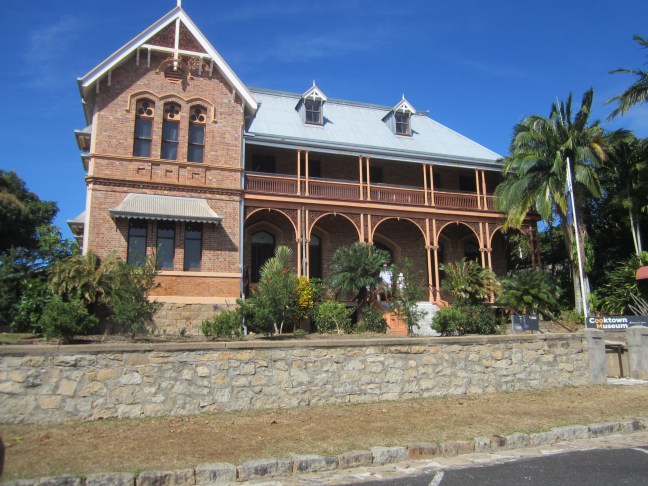
The queen was coming to open the new Cook Museum. Back around 1900, the Sisters of Mercy opened a convent and boarding school in the building above. They got evacuated to near Rockhampton in around 1942 and never returned. The building fell into disrepair but a museum was needed and the queen was coming. I think the story goes that Joh Bjelke-Peterson was premier at the time and government money was put into acquiring the building and they had 10 months to restore before the queen arrived. More recently an addition has been gently added to the back. An interesting museum and commemoration to the nuns.

the other evacuees were the aborigines from the Lutheran mission. The missionaries were German. Couldn’t have them indoctrinating the aborigines! They didn’t survive well in the cooler climes of Rockhampton. Joh B-P also had them brought back eventually – to Hope Vale, just north of Cooktown.

the second photo above is near to where the pilot station was.

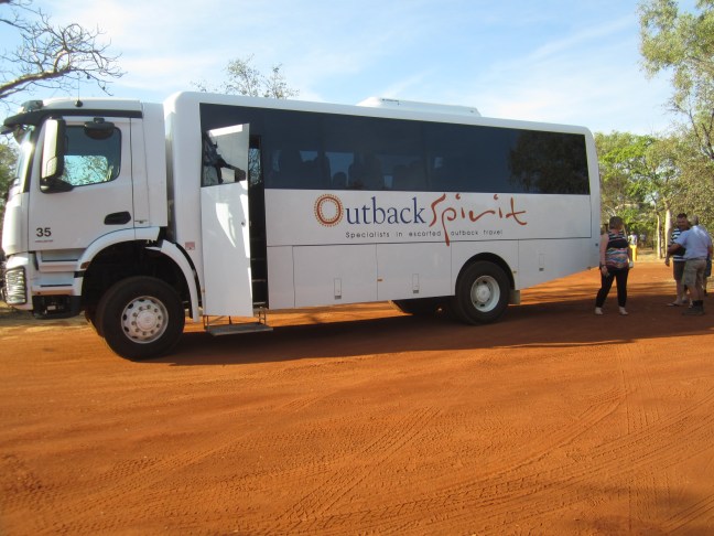
lots of problems with this today. All that was Friday. Don’t know when I’ll get the time and energy to report on Saturday or (now) Sunday. See how I go. Now at a very pleasant camp near Musgrave owned by Outback Spirit with a largely rest day today.

Daintree #2

This is a borrowed photo. Didn’t get it until tonight.
Probably the highlight of yesterday.
we were driving to our third activity and the bus driver announced a cassowary up ahead. The bus has a forward video so we can see the road ahead on the big screen (as opposed to looking through the windscreen). And on the video we could see a very handsome cassowary (turns out it’s always the male that raises the chicks) with very young chick. Wandering about on the road as we approached quite close. (Turns out they are well known to the people we were visiting and are familiar with people being around.) He seemed quite unconcerned about this large bus which had now stopped, but engine still quite loud. Hung about there for what seemed like ages and then they wandered of slowly into the bush. I didn’t have a window seat on that side of the bus, necessary relying on another photographer. Pretty special. Can you see the chick just behind him?

(There were 2 more today, but we were climbing a very steep hill and couldn’t stop.) From my previous time in north QLD, its fairly unusual to see them in the wild.

Today (Friday) has been mainly driving on rough roads. Might have more time tomorrow for a fuller report.

Daintree Day

This was probably out most ‘activity’ day. At least for a while. An early getaway from Port Douglas (after I survived a flooded bedroom! The fridge – hidden in a cupboard. Didn’t even know I had it.- defrosted. Serious pile of towels to stem the tide after I’d got very wet feet turning the light on at 5:30am.)

First stop an indigenous cultural experience and rainforest walk. Interesting enough from an entertaining young man. First a smoking ceremony – we all had to do several circuits of the smoking fire – then various stops illustrating various cultural activities – the red cedar buttresses are good for boomerang construction, revered elders are wrapped in bark and placed in the base of old trees with strangling fig roots encasing the base, a large rock complex used for shelter and ceremonial purposes. (He had to go through the gap and reassure the spirits that we were ok to visit.)

Also in this area, a nice creek and some interesting vegetation. How many types of climbing plants are on the boulder?

Next we went on a bit further to a cruise on the Daintree River. Small shallow-draught tinny with space for 20 or so. They promised crocodile sightings. Seems that they monitor the locally- resident females. Take note of their nest building in November and monitor the egg hatchings in February. We saw 3 females basking in what they hoped might be sun. (We got about 5 min early afternoon, after we had left the river.) Highlight for me was seeing a very young croc on a small branch pretending to bask in the sun. Too far away for a photo. (At least that’s what they said we were seeing. Could have been a plastic model. By then I’d pretty much given up getting any serious info from the guy who clearly hated Victorians. )

So then across the Daintree River on the vehicle ferry and then a long drive with more roadworks and forest on all sides to a family business established on freehold land in the middle of the World Heritage Area – when the area was proclaimed as WHA, the owners were told they could no longer operate an orchard if it brought in more than 10%% of their income. They sold out to the current family – husband and wife who are seriously into rainforest ecology. They run walking tours on their property during the tourist season. Very detailed knowledge and discussion on insects and all living things. Way above my ability to understand it all. Impressive umbrella palms. Some of the trees apparently over 900 years old. Tall palm-type trees that apparently grow 1m every 100 years. So much is highly poisonous. (Famous mushrooms have nothing on this lot.) Oh look at this insect camouflaged on this tree trunk! This is a leaf-eating insect. This morning we saw egg-shaped purple fruit that are apparently poisonous but much loved by cassowaries. Much discussion on how important for the survival of species is the spread of seeds away from the host plant. The cassowaries do a great job with these ‘cassowary plums’. Lots of evidence of passed-through plums ready for germination.

So I’m pretty pooped tonight. No TV or Telstra here tonight so can’t follow the footy. And wifi only in the dining area. Cooktown tomorrow night. And that will be pretty much the end of the tall green forests I reckon. It’s been very green.

and now I’ve got this far it seems I can’t go back and edit obvious typos. Hope you can make sense of it all.

FNQ – on my way

Once upon a time I would carefully write out what I wanted to post. Don’t now have time today, and I suspect our daily timetables won’t give a lot of quiet reflection time if I’ve still got to get on and actually do the post.

I’ve got a long-time rule: it’s always best to come home with wet swim togs. Maybe I could extend that to ‘each day’? At least the weather should suit. Didn’t happen yesterday but I wasn’t going to let the opportunity go by today.

Arrived at Port Douglas mid afternoon. After a walk around the town and a lookout check of the long beach where Kingsford-Smith famously landed, we’ve come to the Sheraton Mirage Resort. Didn’t have time to try out the golf course or go across for a walk on K-S’s beach (4 Mike Beach) but the building my room is in (my pay rate doesn’t get me to a ground floor room with direct access to the pool) is so close to one of the myriad of pools, I had to dig out the togs. (Definitely no pic of me in togs!)

So to Cairns yesterday. I’d picked a hotel quite close to the airport so that was handy for arrival, and I was last pickup on the tour bus at lunchtime as it headed north. Yesterday in a resort that has grown like topsy around a nice old ‘Queenslander’. Cairns Colonial Club Resort. It too has several pools but by the time I completed a much longer walk than intended – got caught up behind the Saltwater Creek and tributaries on the very flat area between the mountains and the sea – and it was nearly dark by the time I got back to my small motel-type room in the complex behind the front entry.

but the facilities were good and staff friendly so I’m not complaining. But if you’re using it as a base to see any more of Cairns, you’d need a car or bike. It’s a fair way from anywhere interesting including shops. Looks like this area previously had quite a lot of similar homes. Most now redeveloped.
weather so far warm and humid but not sunny so not hot. The bus today was actually a bit cool. Might have to pack something longer in my cabin bag.

the most interesting thing about the trip up – it was cloudy for most of the way so didn’t get full benefit from my window seat – we must have done a slow/wide U turn as we approached Cairns. I got quite a startle when we came out of the clouds and the land was on my right. (Ie we’re flying south, not north!)

So the tour has started. 2 staff (driver who is South African but been here 20 years he says and 8 years with Outback Spirit, and a woman assistant.) 16 of us on a 26 seat bus so no problem getting a double seat to myself.

4 Mike Beach from Flagstaff Lookout. The flagstaff has no doubt long. Since gone. Indeed it seems that many things at either long gone or reconstituted. The 1911 cyclones get a big mention. Then another in 1934.
St Mary’s was destroyed in 1911. Rebuilt. Then moved down near the harbour in 1958. Now just a memory of times gone by. Weddings, christenings. Possibly funerals?

Trying to remember how this works

I’m briefly heading off again for 3 weeks in July 2025. But it’s almost 5 years since I last posted here. (there was Covid and a new ankle and a new house – no time for serious travel.) And now I find I’ve completely forgotten how this all works.

This time there will be no bicycles involved!!

Now that I’ve got this far, I’ll try to remember how to do photos as well.